Blackbutt is a rural town, 115 km north-west of central Brisbane. It is situated at the north-eastern end of the Blackbutt Range, and when settled by Europeans the district was described as being between the headwaters of the south-flowing Upper Esk and the north-flowing South Burnett Rivers. The name was given by a Crown surveyor in 1909, using the common trade name for various species of dark barked eucalypts, E. pilularis.
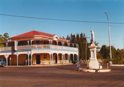
Timber harvesting was Blackbutt's main early industry. Farm selectors came into the district in the 1890s. A primary school opened in 1896. The timber industry was a large employer, and by 1910 there were over 300 people in Blackbutt who, along with employees in outlying timber settlements, supported five hotels. The railway was extended to Blackbutt in 1912, more or less coinciding with the opening of Anglican, Catholic and Methodist churches and a Salvation Army temple. There were also a public hall and a farmers' industrial association.
Sawmilling activity – there were three mills by the late 1920s – cleared much of the surrounding land. It was taken over by cattle grazing and silviculture. An agricultural show society was formed in 1930 and hoop pine plantations were planted which continue to sustain local sawmilling.
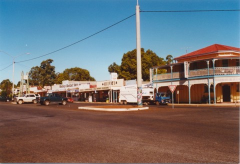
Despite having been a timber town, with the constant pressure of mechanisation replacing labour, Blackbutt's population steadily increased since the 1970s, driven in part by subdivision of former farming properties for rural/residential development. The nearby Tarong Power Station provides a source of local employment, together with local businesses, and small-scale crop and orchard concerns. A golf club was established in 1963. Annual shows, with wood chopping and crosscut saw competitions, continue to be held. There are a hotel and a motel, a visitor information centre, a State primary school, five churches, a public hall, general store, convenience store, sports centre, a forestry office (1988) and a sawmill. The Blackbutt railway line was converted into a recreation trail in 2006.
Blackbutt's census populations have been:
| Census Date | Population |
|---|---|
| 1911 | 333 |
| 1954 | 464 |
| 1971 | 436 |
| 1986 | 481 |
| 2001 | 561 |
| 2006 | 572 |
| 2011 | 1055 |
S.N. Stocks, Cradled in the ranges: a history of Blackbutt, Benarkin, Taromeo and surrounding districts within the Nanango Shire, 1842-1988, Blackbutt, Blackbutt-Benarkin Bicentenary and Centenary Committee, 1988