Boulia, a rural town, is in western Queensland, 190 km east of the Northern Territory border and 240 km south of Mount Isa. It is the administration centre of Boulia Shire, an area of 61,093 sq km.
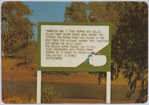
Burke and Wills passed through the area in 1861. Reports by several exploration parties sent in search of Burke and Wills led to pastoralists moving into outback Queensland, and mineral explorations soon followed. Ernest Henry opened up the Cloncurry copper fields and, in the course of their discovery, established a canvas store at a waterhole near where the town of Boulia was established in 1879. It is thought that the town's name was derived from an Aboriginal expression describing the waterhole.
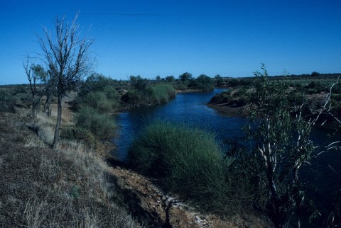
Boulia became the supply centre for the surrounding pastoral country as well as its administrative centre, with a police barracks, court house, post and telegraph office and offices for the Boulia local government division (1887). Town water was obtained from the Burke River (a tributary of a south-flowing system which expends itself east of the Simpson Desert) and from wells sunk about 15 metres deep. Boulia was described in the 1903 Australian handbook:

A Cobb and Co coach service ran from Winton to Boulia (1895-1915), supplemented by camel trains. The western railways terminated at Winton (1899) and Duchess (1912), a mining town south of Mount Isa. The great hope of a linking loop between the two lines, via Boulia Shire, was approved by the Queensland Parliament in 1910 but not built. It was still being talked about in 1946 when Boulia Shire was described in the Australian Blue Book:

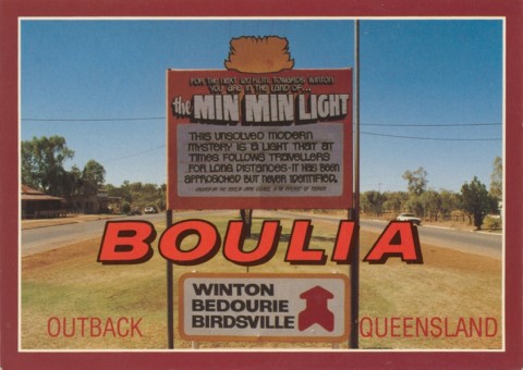
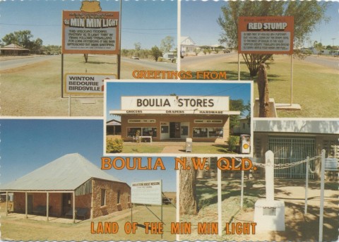
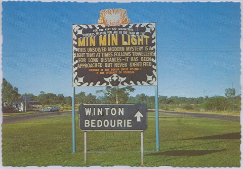
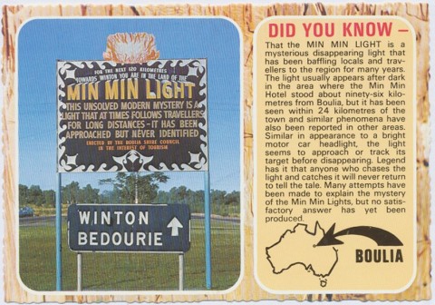
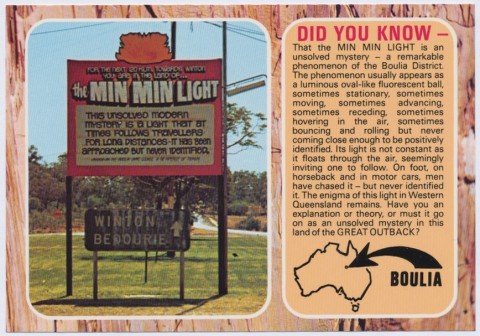
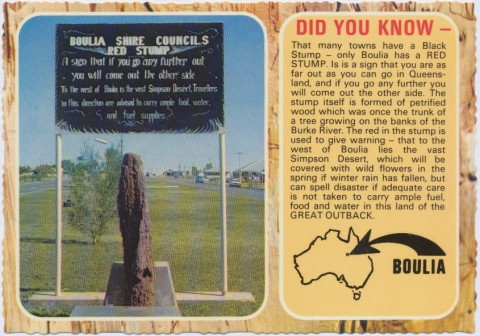
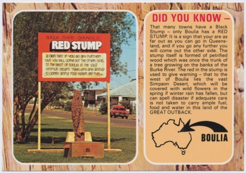
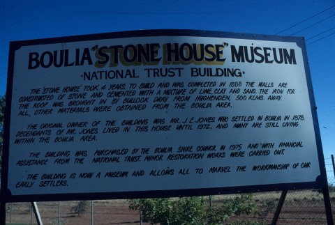
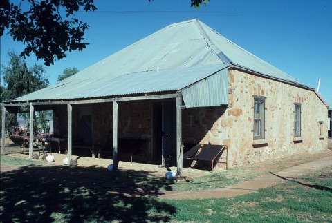
Boulia sits at the junction of two developmental roads, the route from Winton to Mount Isa having a sealed surface for tourist travel. The shire promotes several tourist facilities and attractions, including a museum, an information centre, camel races and the Min Min Encounter Complex that explores the history and myths surrounding the Min Min Lights. The town has a hospital, two motels, a hotel, a school (1889), a public hall, sports facilities and a racecourse. Shade trees line the streets and there is a corroboree tree near the school. A stone house (1880s) used for museum purposes is listed on the Queensland heritage register.
Boulia Shire is sheep and cattle country. In 1994 it had 285,000 sheep and lambs and 171,000 beef cattle.
Damaged by both drought and flooding, the upkeep and funding of the Shire’s roads is a constant priority, including the development of the Outback Way tourist route from Winton to Laverton in Western Australia that passes through the Shire. Often drought-affected, the Shire was briefly transformed by floodwaters in 2009 and again in 2010.
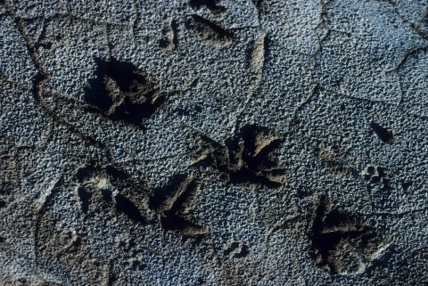
Augmented facilties include an aquatic and sports centre (2005), and a new road into a cattle yard facility which doubles as a drag strip for motorsports enthusiasts (2012). Tourists are drawn to the area through the annual Desert Sands Camel Race and the Back-to-Boulia celebrations as well as significant fossil finds in the shire. Fossils believed to be the earliest ancestors of modern sea turtles and reportedly 110 million years old, were found near Boulia by palaeontologists from the South Australian Museum in 2005.
The Federal Court of Australia recognised native title rights over more than 30,000 square kilometres of land in western Queensland in 2012. The Court recognised the rights and interests of the Pitta Pitta people over 66 parcels of land near Boulia. The claim was first lodged in 1999. An Indigenous land use agreement was negotiated between the State and the Pitta Pitta people.
Boulia and Boulia Shire's census populations have been:
| census date | population | |
|---|---|---|
| Boulia | Boulia Shire | |
| 1881 | 25 | |
| 1911 | 438 | |
| 1921 | 959 | |
| 1954 | 764 | |
| 1961 | 300 | |
| 1981 | 660 | |
| 2001 | 290 | 665 |
| 2006 | 205 | 419 |
| 2011 | 230 | 480 |
Kay Cohen, More than surviving: the Boulia story, Corinda, Pictorial Press, 2001