Brookfield, a partly residential and partly rural suburb, is south-west of Mount Coot-tha Forest. It adjoins Moggill Creek and the suburb of Kenmore, and is 12 km south-west of central Brisbane.
Originally well forested, Brookfield was a timber-felling area, and logs were rafted down Moggill Creek to the Brisbane River in the 1850s. Rafting Ground Reserve, about 1.5 km upstream of the mouth of Moggill Creek, is a reminder of the early industry. In the late 1860s the first of several farm selections were taken up, and the settlement was vaguely known as Indooroopilly or Moggill Creek. A more precise location name was hit upon when an application was made for a school, the request being addressed from 'Brookfield, late Moggill Creek'. It is believed that Lucinda Brindlecombe, of an early settler family, suggested the name in 1868. She may have had in mind the course of the Moggil Creek or had lived at or near Brookfield in New South Wales, north of Newcastle.
The community also constructed a Bible Christian hall, the forerunner of a more elaborate building (1880s) which serves as the local Uniting Church. A cemetery site was reserved in 1872, a government school and a post office were opened and Pattersons Bon Accord sawmill began in 1875. Dairying was started in the 1880s and away to the north the Gold Creek reservoir was built during 1881-85. The reservoir was one of several storages in the district, others being Enoggera and Lake Manchester.
The cemetery, school and Bible Christian church were around the intersection of Brookfield and Rafting Ground Roads. In 1893 the community's centre was enlarged with the Anglican Church of the Good Shepherd, which is listed on the Queensland heritage register. Brookfield was described in the 1903 Australian handbook:

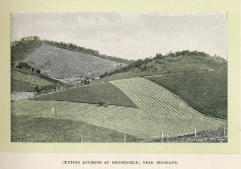
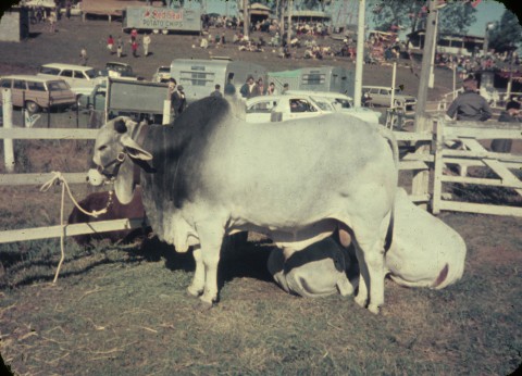
In 1911 the showground and recreation reserve were gazetted. The Brookfield and Moggill Show Society had been formed 1905, and soon involved neighbouring Pullenvale. The district was important for dairying and fruit growing, and Brookfield was well known for pineapples and other tropical fruits. Making do with the original Bible Christian church as the local hall, the community in the 1930s re-constructed a larger building that had been used as a hall in Darra.
Upper Brookfield, for long an outlying settlement, opened a school in 1916. It encloses the headwaters of the Moggill Creek and is predominantly rural.
Brookfield's population gradually increased from a few hundred before World War II to nearly 1000 in 1970. Residential subdivisions appeared in the east, just over the Moggill Creek from Kenmore. A high school on Kenmore's border was closer to Brookfield's residential area than to much of Kenmore. During the 1990s Brookfield's population doubled to about 3500, the built-up area extending west along Moggill Creek to the original community centre around the school and the showground. There are local shops in Brookfield Road near the showground.
In January 2011 flooding form Moggill Creek covered stream-side linear parks. On the other side, in Kenmore, flooding was more serious.
Brookfield's census populations have been:
| Census Date | Population |
|---|---|
| 1911 | 224 |
| 1954 | 469 |
| 1966 | 798 |
| 1981 | 1326 |
| 1991 | 1726 |
| 1996 | 2645 |
| 2001 | 3532 |
| 2006 | 3779 |
| 2011 | 3702 |
Upper Brookfield's census figures have been:
| Census Date | Population |
|---|---|
| 1954 | 278 |
| 1976 | 396 |
| 2001 | 552 |
| 2006 | 644 |
| 2011 | 655 |
Libby Wager, Historic Brookfield, Pullenvale, Pullenvale Field Study Centre, 1988