Chelmer, a residential suburb, is on the south side of a bend in the Brisbane River, opposite Indooroopilly and 8 km south-west of central Brisbane.
Chelmer, along with its surrounding neighbours, Graceville and Sherwood, was known as Boyland's Pocket; Thomas Boyland leased the area for cattle and sheep grazing during the 1840s-50s, as far afield as the Oxley and Blunder Creeks. When the Brisbane to Ipswich railway line was opened in 1876, the station on the south side of the river crossing was named Oxley Point. A considerable part of Chelmer was low-lying, and in 1893 all of the area east of the railway line was inundated. A narrow riverbank margin on the west side was also flooded, and the railway bridge was flooded. The name Chelmer seems to have emerged during the previous decade: Oxley Point station was renamed Riverton (1888), and a siding was installed some distance south in 1881. In 1889 the siding was converted to a station named Chelmer and Riverton was discarded. The origin of the name is apparently unrecorded.
Chelmer gained some notoriety when the new Albert railway bridge was opened in 1895. The flood also deposited a sandy beach downstream from the bridge, providing a popular picnic area until worn away in the 1930s. In 1896 the Brisbane Golf Club was established at Chelmer, remaining there until 1903 when it transferred to Yeerongpilly. The club house still stands at the corner of Honour Avenue and Hurlton Street.
A school of arts/community centre was opened in 1922 and a progress association (1917) became increasingly busy. The school of arts was used for the first local Anglican church services (1923). Local associations and bodies as far away as Ipswich formed a bridge league, headed by the president of the Graceville progress association, Walter Taylor. They wanted the Chelmer-Indooroopilly ferry service replaced by a road bridge, and the Walter Taylor bridge was opened in 1936.
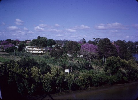
Chelmer had been urbanised with large interwar Queenslander houses. The choicest sites were along the flood proof Laurel Avenue on the western side; in 1999 Laurel Avenue was voted as Brisbane's best street, with trees, grand homes and space. The legal world has supplied several notable residents. Death and retirement has seen sites go up for sale, some with subdivisional potential uppermost in buyers' minds. In one case a verandah was lopped off a Queenslander to supply space for a subdivision.
Chelmer has two large public parks, the easternmost including the bowling club (1954). The elderly persons' Neilson Home overlooked the once-popular Sands where picnic parties and swimmers gathered in the 1930s. (The home was demolished in 2006 and the residents transferred to Greenslopes pending redevelopment of the site.) A local State high school, Milpera, was opened in 1998 on a site formerly occupied by a Special School (1984).
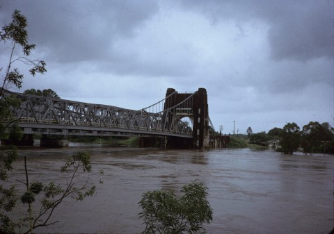
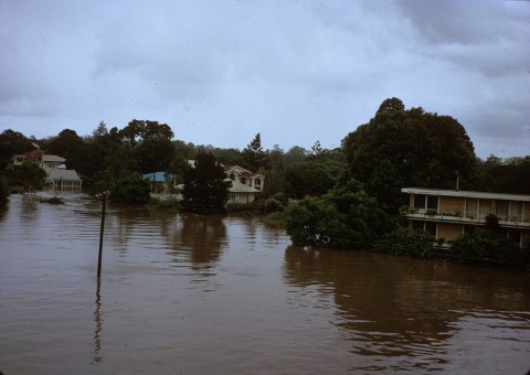
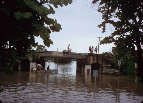
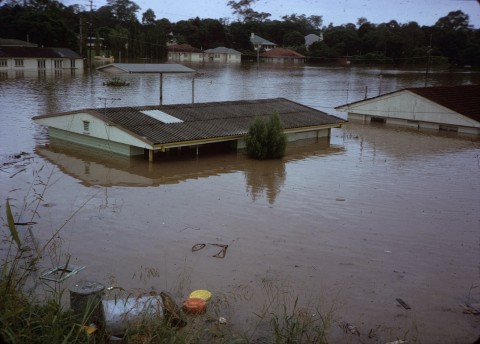
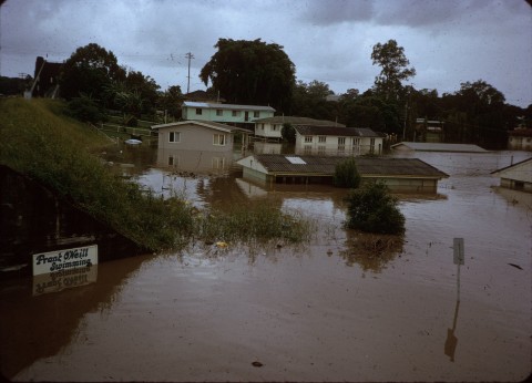
Floods 2011
The census population of Chelmer have been:
| census date | population |
|---|---|
| 2006 | 2560 |
| 2011 | 2594 |