Gladstone's suburbs grew in two decades, the 1960s and 1970s, brought about by the rapid industrial growth described in the Gladstone entry. Before then, the town had on its outer edges the airport, the hospital, Gladstone High School (1953) and the racecourse. Its urban growth was mainly to the south and south-east of the city centre.
West Gladstone is south-west of the city centre. It has the Gladstone Central drive-in shopping centre and the Stockland Shopping Centre (1977), a State primary school and a Catholic high school, both in 1966. It also has the hospital, State high school (1953) and racecourse.
South Gladstone has a State primary school dating from 1898, but its significant growth period is traceable from the opening dates of the Toolooa State high school (1981) and the nearby Trinity College (1985). It also has a TAFE and two out-of-town cinema sites.
Sun Valley is immediately south of West Gladstone and South Gladstone. Its name was devised by a land/housing developer.
Further out of Gladstone to the south there are the suburbs of Clinton (State primary school 1974, Catholic primary school 1977) and Kin Kora (primary school 1981). Both places have historic names dating from survey work in 1853-55: County of Clinton and Kin Kora Creek, derived from Irish nomenclature. Clinton also has Gladstone's airport, and recreation reserves on its eastern boundary.
Between Clinton and Kin Kora there is New Auckland, named after Auckland Creek, the suburb's eastern boundary. The creek was named after the sailing vessel, Lord Auckland, which brought some of the first settlers to Gladsone in 1847. New Auckland was originally a housing estate.
To the east of Auckland Creek there is Telina, and to its east there is Toolooa. Telina was also a housing estate, but Toolooa is an old locality name which had a railway station on the North Coast line. It is thought the name derived from an Aboriginal expression for Barney Point (see below).
South of Toolooa there is Glen Eden, a new suburb.
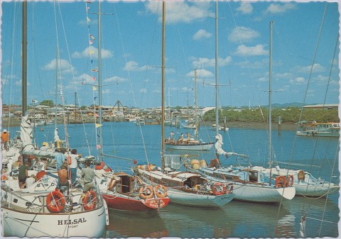
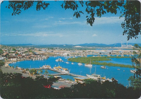
The industrial suburbs are Callemondah and Barney Point. Exclusively industrial, Callemondah has railway marshalling yards, coal stockpiles, a power house, sewage treatment works, harbour facilities and the Gladstone Marine Campus of the Central Queensland University. Barney Point also has railway and harbour facilities, a maritime museum and a small beach with an adjoining residential area with parklands and a bowling club. The origin of the name Callemondah is possibly Aboriginal, but otherwise obscure. Barney Point was named after George Barney, Superintendant of the settlement at Port Curtis (Gladstone) in 1847, arriving there ahead of the Lord Auckland settlers.
Leading employment sectors in all of Gladstone's suburbs are technical and trades workers and machinery operators.
| area | population | |
|---|---|---|
| 2006 | 2011 | |
| Clinton | 5734 | 5917 |
| Glen Eden | 965 | 1969 |
| Kin Kora | 2606 | 2686 |
| New Auckland | 4027 | 4711 |
| South Gladstone | 3120 | 3626 |
| Sun Valley | 1231 | 1469 |
| Telina | 2087 | 2179 |
| Toolooa | 1148 | 1164 |
| West Gladstone | 5302 | 5201 |
| Callemondah | - | 51 |
| Barney Point | - | 1156 |