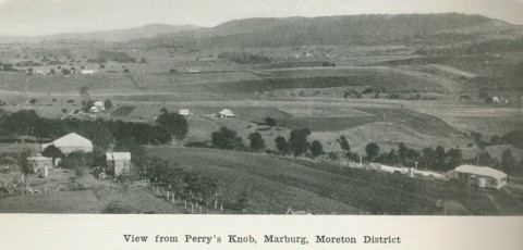
Marburg, a rural town, is 17 km west of central Ipswich and 55 km west of Brisbane, just off the Warrego Highway en route to Toowoomba. Marburg is within Ipswich.
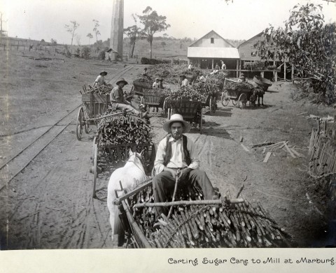
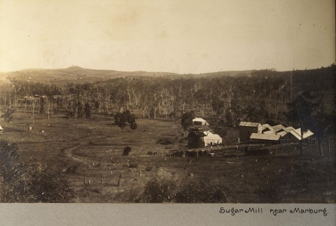
Marburg was once covered by the Rosewood Scrub which was cleared and the area settled predominantly by German farmers in the 1870s. An exception was the Woodlands Estate (1868), selected by Charles Smith, who by the early 1880s installed a sawmill, a sugar mill and a rum distillery. His son, Thomas Lorimer Smith, built the heritage-listed Woodlands mansion (1890) at the end of Seminary Road. Many of the German farmers supplied the mill with cane, but within a few seasons it was found that rainfall was too low for good production. Farmers turned to maize and dairying, although the mill continued to operate until 1918.
Marburg, north of Frankfurt in Germany, is the burial place of the Prussian King Frederick the Great (1712-86), making it an attractive choice of name for the German settlers. As a result of the anti-German feeling in World War I, Marburg was known briefly as Townsend (1917-20).
The Marburg area was intensively settled and in 1891, when a courthouse was opened, a census population of 200 was recorded. In 1903, a decade before effective timber clearing enabled more farmers to settle, Marburg was described in the Australian handbook:

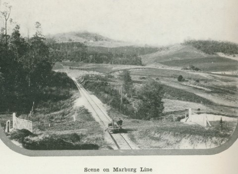
In the 1880s an unsuccessful attempt was made to have a branch railway opened from the Ipswich line to Marburg, but it took until 1911 for the Government to build a line from Rosewood. A circuitous line, it served several coalmines north of Rosewood, ending at Woodlands.
Marburg served as the administrative seat of the Walloon Shire until 1917, when the shire was abolished and divided between adjoining shires.
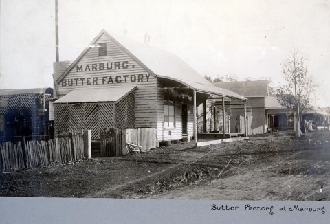
Dairying was an important industry, supplying the butter factory in Marburg. By 1924 Pugh's Queensland Directory recorded the town as having two hotels, three storekeepers, blacksmiths and wheelwrights, with about 70% of the businesses bearing German names. As dairying declined after World War II, so too did Marburg's population - from a population of over 600 in 1954 to fewer than 400 by the late 1960s. Since the 1980s the population has recovered, as Marburg has much to offer people seeking a rural/residential lifestyle close to Ipswich.
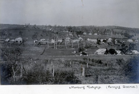
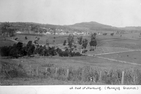
Marburg's town centre is in Edmond Street, a thoroughfare detouring from the Warrego Highway. It has local shops, a showground, four churches, the heritage-listed Marburg Hotel (1881) a State primary school (1879), local hall, community centre in the heritage-listed former National Bank building (1912) and the Rosewood Scrub Historical Society in the former Walloon shire office (1913, also heritage-listed). Next door there are the heritage-listed war memorial (1919) and community centre (1912), originally built for the Queensland National Bank. A former German Baptist church has been converted to a craft and coffee shop, while several antique shops and the annual Oktoberfest all attract tourists.
Immediately east of Marburg on the former Walloon scrubland is Haigslea, known as Kircheim until 1916. Anti-German feeling resulted in the Allied General Douglas Haig being remembered by the renamed village. Kircheim was intensely German (over 60% of farmers in 1913 had German family names), and German settlement extended from Marburg to Walloon. In 1874 the Walloon-Kircheim community erected a Lutheran church. The richer Rosewood scrubland intensified settlement in Marburg's direction, and when a cyclone flattened Kircheim/Haigslea's church in 1924 it was not rebuilt. Haigslea's census populations have been:
| census date | population |
|---|---|
| 2006 | 422 |
| 2011 | 414 |
Haigslea primary school (1876) had 34 enrolments in 2013.
Immediately east of Haigslea there is Ironbark, formally named in 2000. It includes the Borallon Correctional Centre (1990) which is managed by a private-sector firm for the Queensland Government. The name seems slightly astray, as Borallon is about six km north of the correctional centre and separated from it by Sandy Creek. The correctional centre's guests appear to comprise about two-thirds of Ironbark's census population with a disproportionate number of males counted and an Aboriginal and Torres Strait Islander population of 16.1%.
Ironbark's census populations have been:
| census date | population |
|---|---|
| 2006 | 817 |
| 2011 | 846 |
Marburg's census populations have been:
| Census Date | Population |
|---|---|
| 1891 | 200 |
| 1911 | 651 |
| 1954 | 659 |
| 1966 | 393 |
| 1981 | 409 |
| 2001 | 590 |
| 2006 | 536 |
| 2011 | 567 |
Frank Snars, German settlement in the Rosewood Scrub: a pictorial history, Rosewood, Rosewood Scrub Historical Society, 1997
100 years of Christian witness: Kircheim 1885 to 1985 Haigslea, Rosewood Uniting Church, 1985