Toowong, an inner residential suburb, is four km south-west of central Brisbane. It is thought that the name was derived from an Aboriginal word describing a bird, or the call of a bird, possibly the Koel or Cooee bird, a species of Cuckoo. Its call is described as loud and mellow, not unlike a cooee.
With a backdrop of Mount Coot-tha and the Toowong Creek wending down to the Brisbane River, Toowong was an attractive place for settlement. Land sales for farms in both Milton and Toowong occurred in the 1850s, and by the 1860s the area was noted for villa estates along the river and on the ridges. Milton House (1854) was a notable early example. By 1862 the village of Toowong was a recognisable place, promoted by a cab driver who operated between there and Brisbane; he named the destination Toowong.
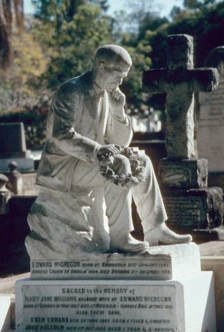
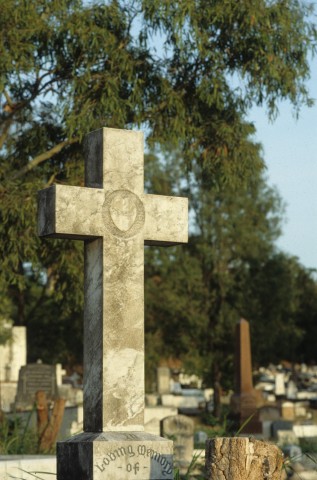
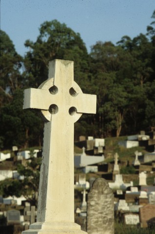
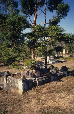
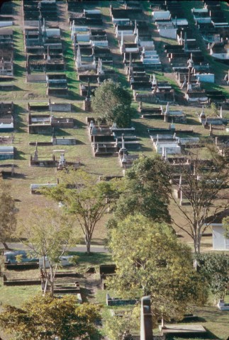
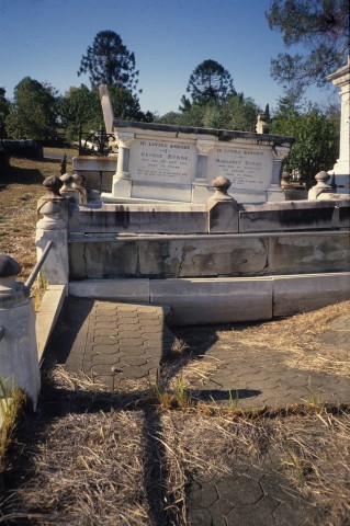
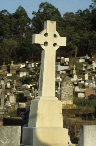
An Anglican church was opened in 1866 and in 1871 a resting place was chosen on the foothills of Mount Coot-tha for metropolitan Brisbane's deceased persons. Inner urban cemeteries had been a health concern for some years - Toowong had been recommended as a metropolitan facility in 1861 - and in 1871 Toowong received its first interment, Governor Blackall. The cemetery and several of its monuments are listed on the Queensland heritage register.
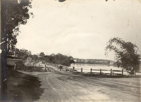
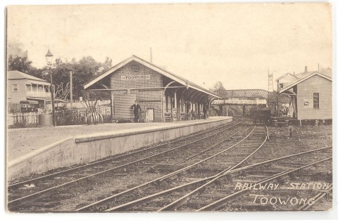
In 1875 the Brisbane to Indooroopilly (and Ipswich) railway line was opened, with a station at Toowong village. The Regatta Hotel was opened the same year, on River Road (Coronation Drive) overlooking Toowong Reach. Settlement became brisker, the Anglicans relocating from the wooden church (1866) in Curlew Street to the Stone Gothic revival edifice in High Street (1877) and a Primitive Methodist church opening in 1876.
The Toowong district had a population of about 1000 people when an area of 4.5 sq miles (11.7 sq km) was proclaimed Toowong Shire in 1880. It included Torwood and Milton (south of Boundary Road), Auchenflower and Toowong southwards to Toowong Creek. The western boundary approximated the summit of Mount Coot-tha. Most of the residential subdivisions were 32 perch blocks (approximating an area enclosed by 15 x 50 metres), and as the subdivision pattern unfolded it was touched by early town planning and garden city ideals: the shire's first chairman, Augustus Gregory, promoted the reservation of Mount Coot-tha as a park and the council later spent money on landscaping River Road and the improvement of several parks.
An electric tram service began in 1903 along Milton Road to the cemetery, and then along Dean Street and Woodstock Road to the terminus. Toowong was described in 1903 in the Australian handbook:

Toowong Shire was designated a town in 1903, consistent with its urbanisation, train and tram services. From about 900 dwellings, the number grew to about 2500 by the early 1920s. In 1925 Toowong municipality was incorporated into the Greater Brisbane council.
Toowong had a pronounced non-Catholic demography, but in 1903 a parish school was transferred to the convent in Grove Street. In 1930 a new brick church of St Ignatius Loyola was built there, and in 1948 a new school was also constructed. The site adjoined Brisbane Boys College, transferred from Clayfield to Toowong in 1930. The convent, church and the boys' college are listed on the Queensland heritage register. In 2007 the Queensland Academy for Science, Mathmatics and Technology (year 12) was opened on the site of the Toowong State College (1963).
In 1962-63 bus services replaced the Toowong tram service, the first move in a process to retire the metropolitan tram service in 1969.
Toowong has the Anzac Park and Toowong Park sport and recreational facilities and a sports ground on Toowong Creek near Brisbane Boys College. Coronation Drive and the Regatta Hotel are both listed on the Australian heritage register.
Toowong Village drive-in shopping centre (1986), west of the railway station, is a sub-regional retail hub, quite in contrast to its Village name. It has a department store, a discount department store and about 90 other shops.
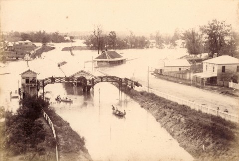
FLOODS 2011
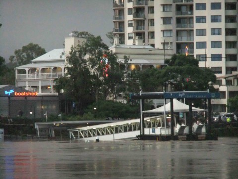
Floodwaters from the Brisbane River invaded Toowong through Moorlands Park, and in doing so engulfed Toowong Memorial Park, Coronation Drive and the Regatta Hotel. The Regatta ferry terminal was swept away. It was reopened, but closed again in 2014 for upgrading. In March 2015 a new terminal opened featuring a flood-resilient pontoon and a 75-tonne, 11-metre high pier designed to deflect debris away from the terminal.
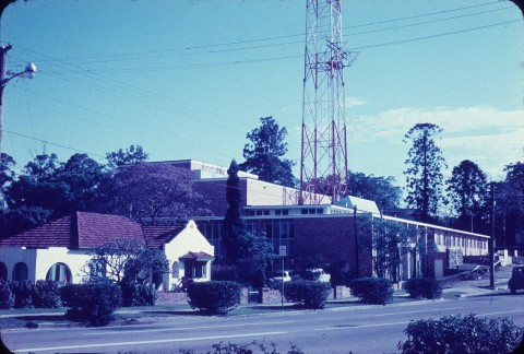
The Australian Broadcasting Corporation (ABC) site abutting Coronation Drive in Toowong was abandoned in 2006 following the detection of a cancer cluster where at least 18 women who worked in the studio were diagnosed with cancer. The ABC tower, a landmark on the site, was demolished in 2015, in preparation for building the so-called 'Champagne flute towers' despite a number of traffic impact issues remaining unresolved.
Toowong census populations have been:
| Census Date | Population | |
|---|---|---|
| Toowong municipality | 1881 | 1275 |
| 1891 | 4347 | |
| 1911 | 6286 | |
| 1921 | 9987 | |
| Toowong including Auchenflower | 2001 | 13,116 |
| Toowong excluding Auchenflower | 2006 | 9875 |
| 2011 | 11,255 |
Helen Gregory, A church for its times: the story of St Thomas' Church, Toowong, Toowong, Parish of St Thomas, 1977
Leigh Chamberlain and Lindy Salter, Toowong: a tram ride from the past, Toowong, Toowong and District Historical Society, 2008