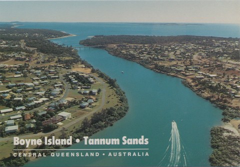
Boyne Island, a residential and industrial town, is 10 km south-east of central Gladstone. It is separated by narrow channels from the mainland and is bordered by the Boyne River to its south-east. It is named after the river, which was charted by John Oxley in 1823.
Boyne Island was the province of squatters from the 1850s until 1863, when the first pastoral lease was granted. Government resumptions in the 1870s opened much of the land to selection, and further leasehold. Resumptions in 1883 resulted in the establishment of farming and agricultural selections.
Included in these early selections was a block taken up by Yorkshire naturalist Charles Hedley in 1882. Hedley attempted fruit growing, but sold out to William Wyndham in 1888 after an incapacitating accident. Wyndham continued fruit growing, raising trees from seeds and specimens obtained from Kew Gardens and India. Wyndham's grave and several remnant fruit trees are listed on the Queensland heritage register, together with St Luke's Church of England, built by the local community in 1924.
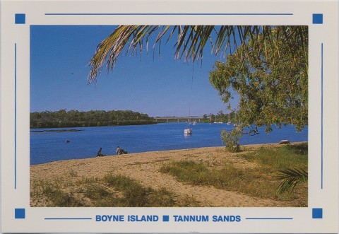
Boyne Island was a small farming community until the 1930s when it also became a minor holiday resort, the bridging of the Boyne River in the interwar period allowing easy vehicular access from the mainland. In 1967 an alumina refinery was opened in Gladstone, and part of the refinery's output is allocated to a smelter (1982) on Boyne Island. The refinery is west of the residential area, and overlooks Boyne River as are two large residue ponds. Construction of the smelter began in 1979 and by 1982 the combined populations of Boyne Island and Tannum Sands had grown from 1400 to about 6000. The two places are linked by the John Oxley Bridge. A second bridge crossing was proposed in 2014. The smelter is Queensland's largest electricity user and employed 1200 people, although job losses of about 90 were announced in 2012, following an upgrade of the carbon bake furnance at the smelter to reduce pollution.
Boyne Island has a shopping plaza (1982), a medical centre, a country club (golf), three motels and a primary school (1953). Boyne Island Conservation Park lies between the town and the smelter.
The Gladstone Regional Council approved a large residential and commercial complex in 2012 at Jacaranda Drive, near the Boyne River, that included a country club, tavern, 160 units, motel and sport and recreation facilities and three residential towers up to 10 storeys high.
In 2013-14 tropical cyclones Dylan and Oswald caused extensive erosion to the coastline, only metres away from homes along Island Boulevard near the Boyne River mouth.
The popular Boyne Tannum Hook Up fishing competition is held annually, despite the temporary loss of the Bray Park pontoon which was washed away in the Australia Day flood in 2013.
Boyne Island's census populations have been:
| Census Date | Population |
|---|---|
| 1921 | 25 |
| 1961 | 63 |
| 1986 | 2200 |
| 1996 | 3184 |
| 2001 | 3539 |
| 2006 | 3687 |
| 2011 | 4406 |
Lorna McDonald, Gladstone: city that waited, Brisbane, Boolarong Publications, 1988