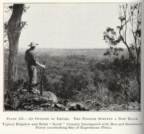
The Brigalow Belt, or Brigalow Country, is west of the Dividing Range, extending from the Townsville region to northern New South Wales. It is characterised by a hardy wattle Acacia harpophylla, a root-suckering tree that grows to 25 metres high. 'Brigalow' is thought to be an Aboriginal word referring to various species of wattle. Ludwig Leichhardt referred to Bricklow scrub in his exploration journal (1844), and Surveyor-General Mitchell mentioned Brigalow scrub in 1848.
In more recent times the Brigalow Belt referred to uncleared country extending north from Taroom to Nebo, which was identified for the Fitzroy Basin Brigalow Development Scheme (1962). Brigalow country had an historically bad reputation. In 1884 Sir Samuel Griffith described the country between Dalby and Roma as 'horrible brigalow': ringbarking caused suckering, making the scrub worse and further limited pastoral use. The few areas that had been cleared of brigalow fell prey to prickly pear infestation in the early 1900s. When the infestation was killed off in the 1920s, cleansing fires destroyed the waste and uncovered productive soils. The process, however, could not be economically replicated until postwar mechanisation.
The Brigalow Development Scheme involved 11 million acres in the former shires of Banana, Bauhinia, Broadsound, Duaringa, Nebo, Peak Downs and Taroom. Bulldozers hauling heavy chains crushed the scrub, followed by burn-offs, aerial herbicide spraying and (costlier) disc ploughing. Farm blocks averaged 8000 to 10,000 acres, and new settlers often lived in tents or tin sheds while getting established.
A brigalow research station was established in 1965 between Theodore and Moura. It has found that the mostly fertile soils have high inherent salt loads and are erodible. Contour ploughing has become common practice. This has been less of a problem in grazing properties where shade trees and shelter belts have been kept. It is estimated that cattle numbers in the Fitzroy Region tripled since the days of wild, unbranded cattle in the brigalow scrubs. The intensity of land clearing (only 2% of the brigalow belt is in conservation areas) has caused concern about species and habitat loss. Conquest of the brigalow pest has relieved the contempt factor and produced a twinge of sentiment. Biloela, in the Callide Valley in the former Banana shire, rebadged its annual art show as the Brigalow Arts Festival in 1995.
The rural village of Brigalow is in Samuel Griffiths' 'horrible Brigalow' country, on the Warrego Highway, 25 km south-east of Chinchilla. Its primary school opened in 1908. From having a hotel and three churches, only the Uniting church continues. There are a hall, a recreation reserve and a general store.
Brigalow village and district's census populations have been:
| census date | population |
|---|---|
| 2006 | 457 |
| 2011 | 401 |
The brigalow story, Brisbane, Land Administration Commission, Department of Lands, 1968
Lorna McDonald, Cattle country: the beef cattle industry in Central Queensland 1850s-1980s, Brisbane, Boolarong Publications, 1988
Gordon Mackenzie, Warrigal: brigalow battlers in Central Queensland, the author, 1984
R.S. Porteous, Brigalow (fiction), London, Angus and Robertson, 1957
Judy Rechner, Taroom Shire: pioneers, magic soil and sandstone gorges, Taroom Shire Council, 2005