Coomera is a growing suburb in the Gold Coast hinterland, 8 km west of South Stradbroke Island and immediately east of the Pacific Motorway. Its southern boundary is the Coomera River and its northern boundary is rural Pimpama.
The Coomera River was mapped by a survey party in 1839 and named the Arrowsmith. Renaming of the River as the Coomera occurred at an unrecorded date, and it is thought that the name was derived from an Aboriginal expression describing a type of wattle bark used to stupefy fish.
Timber was rafted down the Coomera River from the 1860s and the Coomera agricultural reserve was the forerunner of several farms growing mainly sugar, but also maize and potatoes. A school was opened in 1873. When local government was first enacted for Queensland, the Coomera division was one of four covering the South Coast and its hinterland (the others being Beenleigh, Nerang and Waterford Divisions). The Coomera Division extended inland from the coast, between the Logan and Coomera Rivers, an area of 141 sq miles. For some years the Division's office was in the primary school building. Coomera (also known as Lower Coomera) was a mere village, with a post office, a store, the Coomera Hotel and a Wesleyan church according to the Post Office Directory in 1886. A later guide (1890) also mentioned a Church of England.
Coomera was described in the 1903 Australian handbook:
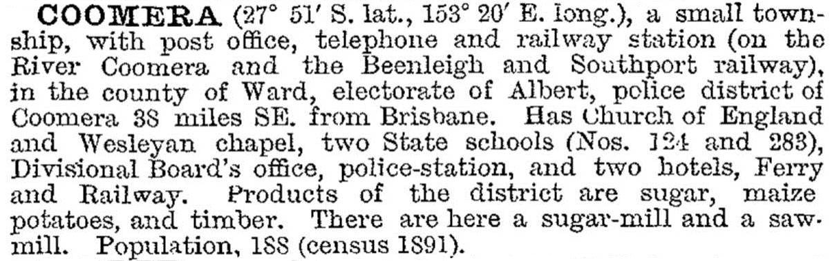
Situated on the north bank of the Coomera River, the village was the place where there was a ferry crossing and a railway bridge for the South Coast railway (1885). Coomera remained a village, however, until well into the 1960s, and censuses recorded higher populations for Upper Coomera, west of the crossing (usually in the 300s) than for Coomera. The South Coast Road became a more convenient highway when the river was bridged in 1930.
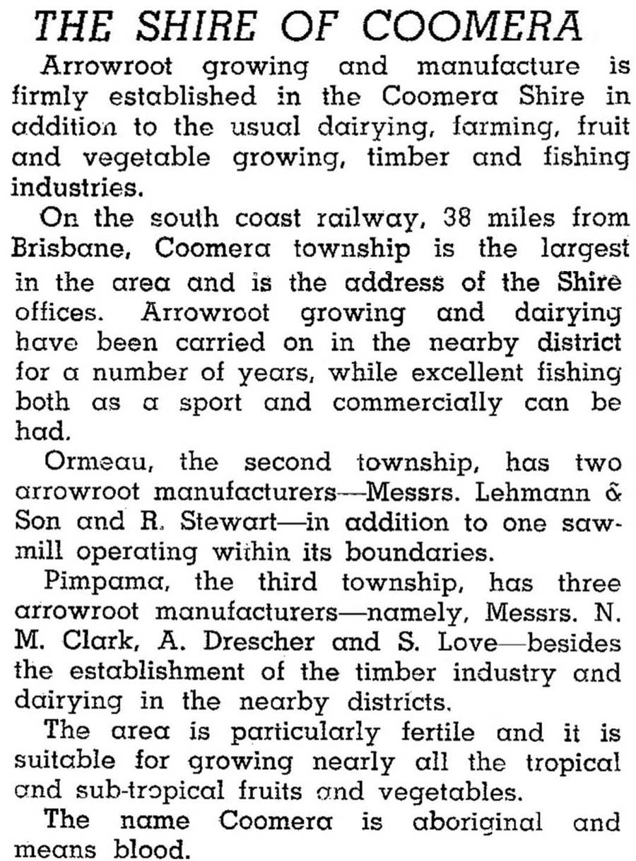
Coomera Shire (the successor to the Division) was described in 1946 in the Australian Blue Book:
In 1949 Coomera Shire was amalgamated with the three others to form Albert Shire.
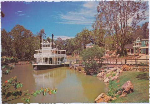
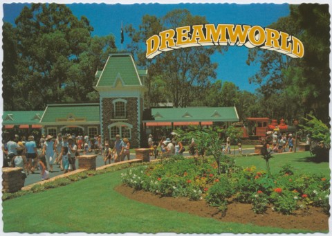
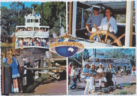
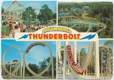
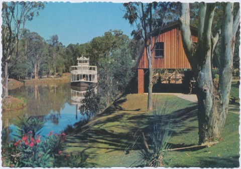
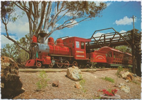
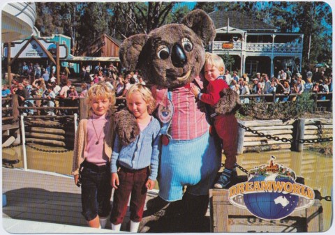
The Pacific Highway/Motorway crossed the South Coast rural hinterland on the journey out of Logan to the Gold Coast, and land could be bought at lower prices than on the coast in the 1970s-80s. A highway theme park, Dreamworld, was opened in 1982 on one such parcel of land. On the other side of the Coomera River a novel development, marketed for luxury and exclusivity, was launched on Hope Island and named Sanctuary Cove. Thus began the Gold Coast's hinterland waterfront estates, which came to Coomera in the 1990s.
A community-based plan for the development of Coomera was adopted by the Gold Coast Council in 1995, providing for plentiful open space, underground power lines and a trend back to grid-design street layouts. Canal estates were not in the adopted plan, although there are riverfront estates, two west of the bridge in Upper Coomera, and Coomera Waters Village and Marina (2001-) opposite Sanctuary Cove. There are also several estates near the primary school and Coomera Village shopping centre.
In 1996, 32 years after the South Coast railway was closed, a new line was opened, along with a Coomera station. Situated out of the town centre, the station is accompanied by a site for a new Coomera town centre (stage one approved in 2014). To the north-west of the station there are undeveloped land and partially developed urban areas; to the east, on the Coomera River, there is the Gold Coast industrial marine precinct, along with a marina. To the station's north-east a new primary school, Coomera Rivers State school, was opened in 2011 reflecting the sizeable population growth in the area. Two new TAFE facilities, Coomera Creative and Coomera Marine (2015), were constructed.
West of the motorway is Upper Coomera, formally named in 1981. Most of the residential settlement in Coomera happened there from the mid-1990s onwards. It has four schools, a town centre (2008), and is described in a separate entry.
In 2014 the Australian Bureau of Statistics reported that five suburbs – Coomera, Upper Coomera, Pimpama, Canowindra and Willowvale – had the highest levels of bankruptcy and indebtedness in Queensland.
A sporting precinct at Coomera is part of the development for the 2018 Commonwealth Games.
Coomera's census populations have been:
| Census Date | Population | |
|---|---|---|
| Coomera | 1881 | 52 |
| 1901 | 210 | |
| 1911 | 412 | |
| 1954 | *466 | |
| 2006 | 4056 | |
| 2011 | 8793 | |
| Coomera Shire | 1891 | 810 |
| 1911 | 845 | |
| 1933 | 1152 | |
| 1947 | 1114 |
Michael Jones, Country of five rivers: Albert Shire 1788-1988, North Sydney, Allen and Unwin, 1988
Upper Coomera entry