Gold Coast City's western boundary follows the Albert River south from Yatala to Tamborine. Logan City is on the other side of the river. South from there the western boundary is an irregular line passing through the Tamborine National Park and the Land Warfare Centre near Canungra and the Lamington National Park, ending at the New South Wales border. The local government body on the other side of this part of the border is Scenic Rim Regional Council, formerly Beaudesert Shire.
The distance covered by Gold Coast City's western border from Yatala to the State border is 60 km, and adjoins Gold Coast City's inner hinterland. From north to south there are rural and rural/residential localities, a few verging on being suburbs. A few have their own entries, as noted below.
Luscombe is immediately south of Yatala, on the east side of the Albert River and 20 km inland from Couran Cove Resort on South Stradbroke Island. It was named after a sugar plantation next to the river. Luscombe's northern area includes the Darlington Park motor sports precinct, latterly the Gold Coast International Raceway, and an industrial estate. Luscombe is relatively elevated and several minor streams run off it. There are two quarries. Luscombe's census populations have been:
| Census Date | Population |
|---|---|
| 1921 | 41 |
| 1933 | 69 |
| 1961 | 48 |
| 2006 | 390 |
| 2011 | 448 |
Cedar Creek is south of Luscombe and has its own entry.
Kingsholme is east of Luscombe and Cedar Creek. It adjoins the Pimpama River and was named after a farm (c1870) next to the river. It was previously known as Upper Ormeau. Kingsholme's census population in 2006 was 527 and in 2011 was 281.
Willow Vale is south and east of Kingsholme and its eastern boundary is shared with urban Upper Coomera. Its north-east corner touches Pimpama. Both of these suburbs have schools and shops. Willow Vale's census population in 2006 was 612 and in 2011 was 1015.
Wongawallan is south of Kingsholme and Willow Vale and 10 km inland from Helensvale. Its western boundary is shared with Tamborine Mountain and Scenic Rim Regional Council. Mount Wongawallan, part of the Darlington Range, is in the extreme north of Wongawallan, and is a conservation area. It includes mature forest and habitat for rare flora and fauna. The name was first recorded in 1868, and it is thought that it derived from an Aboriginal expression describing a pigeon and water. Wongawallan Creek drains south from the conservation park to the Coomera River. Wongawallan's census populations have been 42 in 1933, 762 in 2006 and 1103 in 2011.
Guanaba is south of Wongawallan and extends from Tamborine Mountain to the Coomera River. It is thought that the name derived from an Aboriginal expression for the area around Beenleigh, some 20 km to the north. By 1930 there were sufficient timber-cutting and farming families for a school to be opened. It continued until about 1967. Guanaba has the Gold Coast Polo and Country Club in its north-east corner. The Guanaba Reserve has picnic facilities and a swimming hole on the Guanaba Creek, next to the rural fire brigade. Guanaba's census population in 2006 was 591 and in 2011 was 798.
Maudsland is on the other side of the Coomera River from Guanaba and adjoins urban Pacific Pines. The origin of the name is apparently unrecorded, but Maudsland primary school opened in 1879. The school was in Maudsland Road and is now the site of Cliff Bird Park. After it closed in 1963 the building was moved to Coomera primary school. Maudsland's eastern part is urbanised, and its census populations have been 56 in 1961, 1902 in 2006 and 3215 in 2011.
Clagiraba extends from Tamborine Mountain to the Coomera River and is south of Guanaba. It is thought that the name derived from an Aboriginal name for young or single men's ground. Its western part includes the Canungra Land Warfare Centre and the east includes Clagiraba Forest Reserve near the Clagiraba Creek's headwaters. Clagiraba's census populations were 749 in 2006 and 561 in 2011.
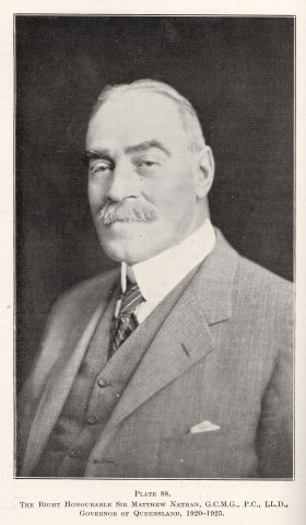
Mount Nathan is on the eastern side of the Coomera River from Clagiraba, and is south of Maudsland. Presumably the mountain was named after the Queensland Governor (1920-25), Sir Matthew Nathan. The mountain is in a descending range in the north of the suburb, and the eastern side of the range includes the Nathan Forest Estate. Allotments are large, with views to the coast. The Silkwood Steiner School (1997) is in the east of Mount Nathan, near Nerang. Mount Nathan's census population in 2006 was 842 and in 2011 was 1124.
Advancetown, south of Clagiraba, extends from Lower Beechmont to Mudgeeraba. It includes the Hinze Dam (Advancetown Lake) at the junction of the Nerang River and the Little Nerang Creek. European settlement began in the 1880s and a hotel, named Beechmont, was opened. It was acquired by a sawmiller, Ernest Belliss, who renamed it the Advancetown. Belliss donated land for the Advancetown primary school (1909-60).
By the 1930s there were about 60 people in Advancetown. A postwar post office directory (1949) recorded Mrs York's Advancetown Hotel, the school and 10 farmers (mainly dairy and banana-growing).
In 1977 the Hinze Dam inundated much of Advancetown and its better farm land. The present hotel off the Nerang-Murwillumbah Road dates from 1975. A caravan park is nearby, and in the opposite direction near the dam's spillway there are a picnic area and boat ramps. The Grand Golf Club is in the north-east corner of Advancetown, accessible only from Gilston by a bridge across the Nerang River. Costing over $30 million, its construction was started in the early 1990s. It lay abandoned for four years and was completed and opened in 1997 by new owners. Advancetown's census populations have been:
| Census Date | Population |
|---|---|
| 1933 | 67 |
| 1954 | 71 |
| 2006 | 360 |
| 2011 | 352 |
Gilston, east of the Nerang River and Advancetown, was apparently named by a local storekeeper after Gilston, Hertford, England or (less likely) either of two Gilstons in Scotland. There was considerable clearing for farms and a school opened in 1881. As Gilston was an outlying locality of Nerang, school attendances were probably boosted by Nerang farm families. The present school was built in 1985 and draws enrolments (575 in 2009) from Tallai and Worongary. Gilston also has a community hall positioned at the original village centre. Its census populations have been:
| Census Date | Population |
|---|---|
| 1911 | 181 |
| 1933 | 121 |
| 1961 | 103 |
| 2006 | 575 |
| 2011 | 1449 |
Austinville, immediately south of Advancetown, has Springbrook (see separate entry) on its west and Bonogin (separate entry) on its east. Austinville encloses several headwaters of the Mudgeeraba Creek. It was named after W.H. Austin, Under Secretary of the Department of Labour and Industry, who was involved in settling families on newly-cleared farms during the Depression. The farms were down the Mudgeeraba Creek valley, hemmed by the Nimmel ranges. A school opened in 1934. It lasted for five years, indicating the short life of the banana-growing enterprise. Austinville has a hall and camping ground, and its census populations were 419 in 2006 and 361 in 2011.
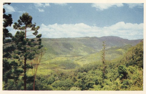
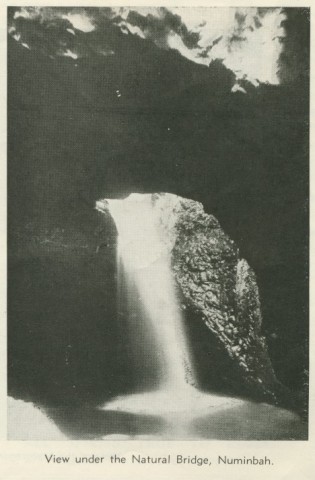
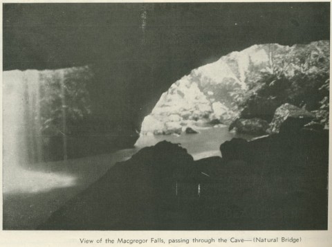
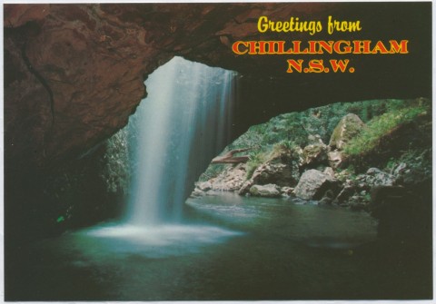
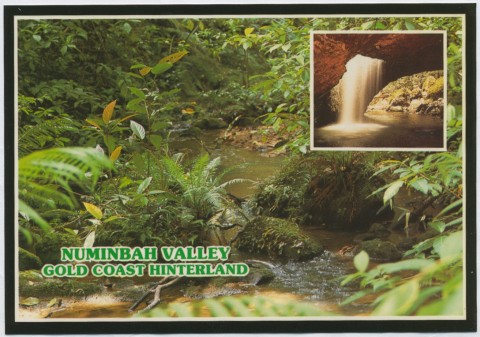
Numinbah Valley is west of Springbrook and extends to Scenic Rim Regional Council (Beechmont). The valley is defined by the Nerang River. The river's headwaters are in Natural Bridge, which is between Numinbah Valley and the New South Wales border. The narrow valley has ranges on both sides, and it is thought that the name is an Aboriginal expression describing how the valley held the ranges close to each other.
Timber cutting gave way to cleared farm patches in the valley. Schools were opened at Numinbah Valley (1927) and at Natural Bridge/Numinbah Upper (1939-91). The post office directory for 1949 recorded a guest house, a sawmill, the Whitinbah State Farm (1940), 27 dairy farms and 7 other farms and banana growers at Numinbah Valley. During World War II Allied troops underwent live-off-the-land training in the valley.
Numinbah Valley has an environmental studies centre (1977), a State forest reserve, a school of arts hall (1927), the Numinbah low-security correctional centre (formerly Whitinbah), and a primary school. Its census populations have been:
| Census Date | Population |
|---|---|
| 1921 | 88 |
| 1947 | 308 |
| 1961 | 161 |
| 2006 | 236 |
| 2011 | 294 |
Pamela Hall et al, Numinbah Valley: a social and natural history 1840s-1988, Numinbah Valley Bicentennial Committee, 1988
Rory O'Connor, Sharing the water hole: Ngalinga mulgerri gwonggubunga: the community story of the Hinze dam catchment, Beenleigh, the author, 2011