Inkerman is a rural village on the Bruce Highway 80 km south-east of Townsville and 10 km south of the Burdekin River. It was named after the Inkerman pastoral station (c1864) which was presumably named after the battle site in the Crimea ten years before. The Inkerman grazing industry was plagued with the cattle tick in the mid-1890s, and the freehold was sold to the Queensland Government in 1910 for farm subdivision.
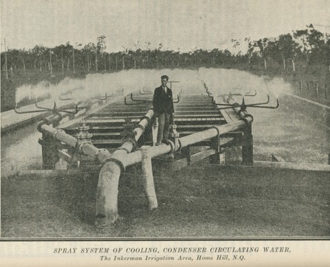
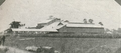
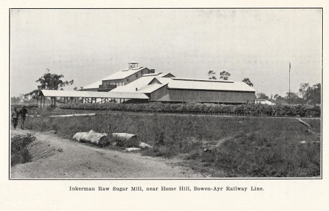
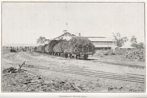
The sugar entrepreneur, John Drysdale, had already attained control and management of the industry north of the Burdekin River around Ayr. He acquired 1280 acres of sugar-growing land south of the river and bargained with the government to build a mill for the subdivided Inkerman freehold. His Inkerman mill crushed the first crop in 1914.
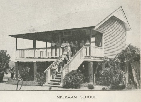
The farm families around the site for the sugar mill asked for a school in 1913 through the secretary of their branch of the Inkerman Farmers and Graziers Association, Lowell Osborne. The Osborne State primary school, a large shed with canvas walls transferred from Home Hill, opened in 1914. A verandahed one-room school was built in 1917.
The farms needed irrigation and the Inkerman Water Supply Board was formed in 1917. Wells were sunk for the electric pumping of water, but costs exceeded the budget. Not until the system was connected to the Townsville electricity grid in the 1950s did it run economically.
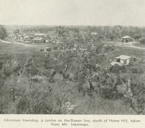
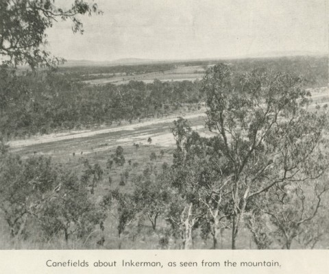
Inkermann has a store, a service station and a caravan park. The school closed in 1974. Mount Inkerman, a short distance north of the village, offers a good view of the cane lands and the Inkerman sugar mill between Home Hill and the Burdekin River. Inkerman's census populations have been:
| Census Date | Population |
|---|---|
| 1933 | 359 |
| 2006 | 520 |
| 2011 | 364 |
John Kerr, Black snow and liquid gold: a history of the Burdekin Shire, Ayr, Burdekin Shire Council, 1984