Innisfail's town centre is on the western side of the Johnstone River and has an area of about 2.5 sq km. 'Greater Innisfail' consists of numerous suburbs, west of the town centre, and to the east and north across the Johnstone River.
Innisfail Estate is east of the town centre and is named after Thomas Fitzgerald's pioneering sugar plantation (1881). It is reached by the Geraldton Bridge from the town centre and has the Johnstone College of TAFE. Its census populations have been:
| census date | population |
|---|---|
| 2006 | 1307 |
| 2011 | 1375 |
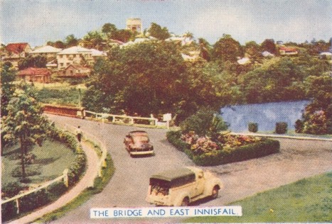
East Innisfail is reached from the town centre by the Jubilee Bridge across the South Johnstone River. It has a state primary school (1958), three churches, a riverside park and a recreation reserve. Its census populations have been:
| census date | population |
|---|---|
| 2006 | 1608 |
| 2011 | 1828 |
South Innisfail adjoins East Innisfail and has a caravan park on the river. Its census populations have been:
| census date | population |
|---|---|
| 2006 | 532 |
| 2011 | 619 |
West of the town centre there are Mighell, Goondi (separate entry) and Belvedere. Mighell was named after the Innisfail businessman and public servant, Sir Norman Mighell and Belvedere was named after a housing estate. Mighell includes the Innisfail High School (1955), a cultural complex and music conservatorium, a riverside park, and the Innisfail cemetery. Mighell's census populations have been:
| census date | population |
|---|---|
| 2011 | 384 |
Belvedere, 3 km west of the town centre, had census populations of:
| census date | population |
|---|---|
| 2006 | 815 |
| 2011 | 852 |