Kangaroo Point, a narrow tongue of land bordered on three sides by the Brisbane River, is immediately north of Woolloongabba. A south side inner suburb, it is three-quarters of a kilometre east of central Brisbane.
COLONIAL INDUSTRY
During Brisbane's convict era stone was quarried at Kangaroo Point for building works in the town across the river. By 1837 parts of Kangaroo Point were being farmed. Land sales (1843) followed the first auction of allotments in north Brisbane by only a year. In 1844 the first of several public houses in Kangaroo Point, the Bush Inn, was licensed.
By the late 1850s it is estimated that Kangaroo Point had about 80 houses, a wharf, a ferry service to north Brisbane, a bone shed, the remains of a derelict boiling-down works dating from the 1840s, a sawmill, a brick-works, and a postal receiving box. The industrial potential of Kangaroo Point, particularly along its shoreline, was becoming evident, and all the land had been sold by 1854.
SUBURBAN GROWTH
A government primary school opened in 1860, and the population had grown to the extent that it was restive about the (north) Brisbane Town Council not spending local rates in the form of local services and facilities. There was unsuccessful agitation for severance during the 1860s, but it led to Kangaroo Point becoming a separate ward in 1865. When the opportunity came in 1888 to join the borough of South Brisbane, Kangaroo Point stayed with the north side council.
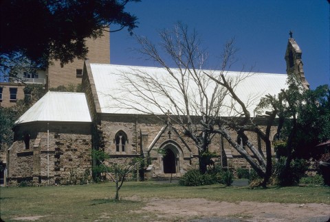
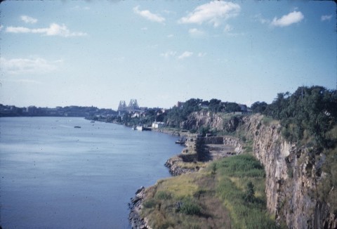
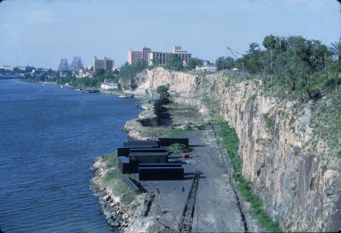
During the 1870s St Joseph's Catholic Church, Leopard Street and St Mary's Anglican Church, Main Street, opened. The Mercantile (later Kangaroo Point) Rowing Club was formed in 1877, and held its first regatta in 1882. The cliffs reserve on the western shoreline were taken over by the council for quarrying, and river wharves advanced in the direction of Kangaroo Point.
The southern part of Kangaroo Point bordered the Woolloongabba One Mile Swamp, and drainage works were completed in 1887, discharging along the Leopard Street drain. The Brisbane Cricket Ground thus became possible. In Kangaroo Point itself, the Pineapple Sportsground, near the Pineapple Hotel (1864) was reserved in 1888, subsequently being named Raymond Park.
MARITIME INDUSTRY
At least three ferries operated between Kangaroo Point and the north side. Two additional vessels, naval gunboats, were moored riverside at the Naval Brigade stores (1887), immediately below St Mary's church in Church Street.
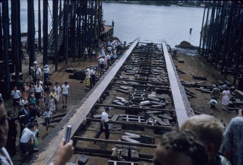
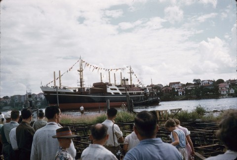
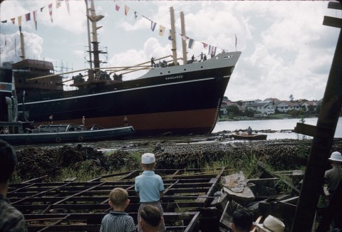
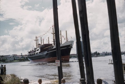
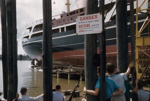
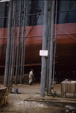
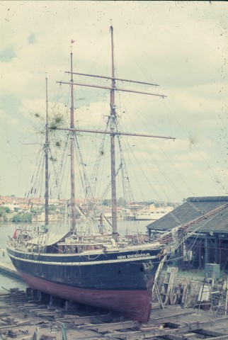
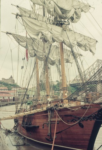
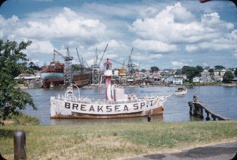
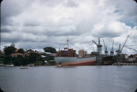
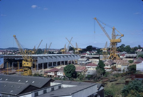
By 1890 the extreme tip of Kangaroo Point was occupied by Sutton and Co, engineering works, and Evans, Anderson Phelan, locomotive works. Anderson's boat slip (1864), later Peter's slip (1873-1992), was on the eastern shoreline and Moars boat slip was a short distance to the south. Moars was taken over by Evans Deakin in 1940 to build naval vessels. Recreational and educational pursuits were furthered by a school of arts (1892), a local cricket team and women's rowing club (1908).
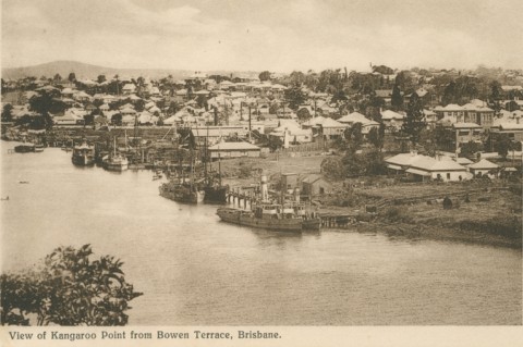
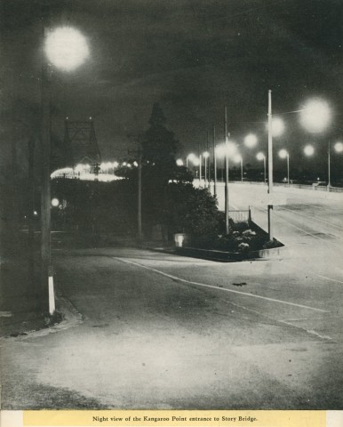
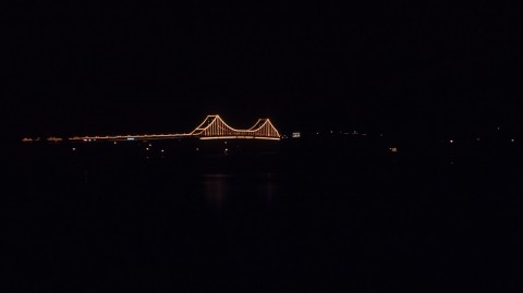
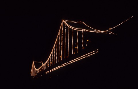
Main Street ran from the tip of Kangaroo Point southward to the Woolloongabba Five Ways. It was flanked by sawmills, tradespeople, cottages, a few larger houses, the Kangaroo Point and Pineapple Hotels, an immigration depot at Wharf Street, the primary school and St Mary's church. Slipways and engineering works were large employers. Evans Deakin's yard continued until 1976, having flourished in World War II and still employed over 1200 people in the 1960s. City workers had the choice of three steam ferries from Edward and Creek Streets and the Customs House. After 1940 they also had the Story Bridge crossing, feeding into Main Street and taking motorists and pedestrians to the Valley. The bridge was named after John D. Story (prominent public figure and member of the bridge construction board) and was designed by Sandgate-born J.J. Bradfield, who had overseen the construction of the Sydney Harbour Bridge.
FLOODS AND CROSSINGS
When the Brisbane River flooded in 1893 most of Kangaroo Point north of Cairns Street was inundated. Bradfield designed the bridge with a high clearance, having in mind the need for ships to pass under it. When Brisbane flooded again in 1974, shipping was unaffected by the bridge because the ports had moved downstream, but the Story Bridge was the only river crossing not blocked by the rising waters. Bradfield's name was remembered when Main Street was widened and named Bradfield Highway between the bridge and St Mary's.
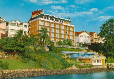
To many the roar of overhead traffic along Bradfield Highway signified the despoilation of Kangaroo Point, which the bridge approaches had cut in two. Nevertheless, cottages were refurbished, parks laid out in place of shoreline industrial sites and a marina built at Peter's boat slip. A TAFE replaced the primary school above the cliffs and in 2009 the State Government demolished it and turned the area into parkland. St Joseph's Catholic primary school continues to serve its parish.
The Clem 7 tunnel, opened in March 2010 and named after Brisbane’s longest serving Lord Mayor, Clem Jones, takes vehicles from Woolloongabba (entrances from Ipswich Road and the Pacific Motorway) and Kangaroo Point (entrance from Shafston Avenue) to Bowen Hills, connecting to Lutwyche Road and the inner city bypass. While the tunnel will decrease traffic congestion around the Gabba the pollution extractor tower, disguised in purple and white panelling, will remain a reminder of the traffic below.
HERITAGE AND MODERN LIVING
The riverside industrial sites on the east side of Kangaroo Point, overlooking Shafston Reach, have been redeveloped for high-rise apartments, and the locality is known as Dockside. Most of this development occurred under the auspices of the Pidgeon building group.
In 1919 Shafston House, Castlebar Street, was converted to Anzac Hostel for incapacitated servicemen, a site overlooking the river's Shafston Reach. The large complex of buildings began with Henry Stuart Russel's Shafston residence (1852), probably the third oldest surviving house in metropolitan Brisbane. It is listed on the Queensland heritage register. After the complex ceased use as a hotel in 1969 it passed through several hands before being redeveloped for Shafston Diploma College (1996). In 2004 Castlebar Street became better known as the address of a riverside 'enclave' comprising 38 residences with private jetties and starting prices of $1.69 million. Kangaroo Point has become an address for the well-heeled. In 2001 the median weekly income of each resident was $525, 26% higher than the median for metropolitan Brisbane.
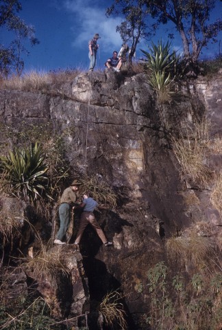
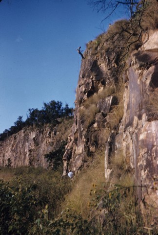
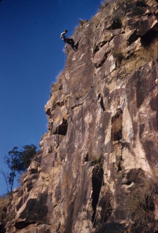
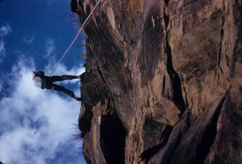
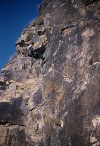
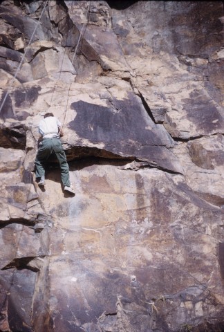
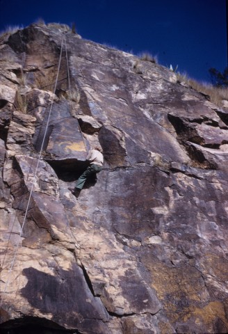
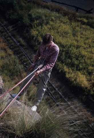
The western side of Kangaroo Point overlooks the Town Reach of the Brisbane River. Much of the shoreline is a linear park, including The Cliffs reserve in the south, popular with abseilers. The reserve leads to Mount Olivet hospital, a Sisters of Charity hospice and associated care facilities built in 1957. There are two ferry-crossing points, and the northern one at Holman Street has a heritage-listed terminal shelter. The Mormons acquired a large site on River Terrace, opening a vast Tabernacle there in 2003.
Kangaroo Point's southern boundaries have been Leopard, Vulture and Wellington Streets for over 100 years. Its census populations have been:
| Census Date | Population |
|---|---|
| 1871 | 1020 |
| 1881 | 1903 |
| 1886 | 3204 |
| 1901 | 3844 |
| 1911 | 4417 |
| 1976 | 3831 |
| 1991 | 4272 |
| 2001 | 5387 |
| 2006 | 6868 |
| 2011 | 7000 |
In 2011, 79% of occupied dwellings were flats, units or apartments compared with 14% for Australia.
Janet Hogan, Living history of Brisbane, Brisbane, Boolarong, 1982
B.J. Martin, ed, Built beneath the bridge: the history of the shipbuilding endeavours of Evans Deakin, 1940 to 1976, Bowen Hills, Queensland Women's Historical Association, 1997