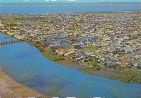
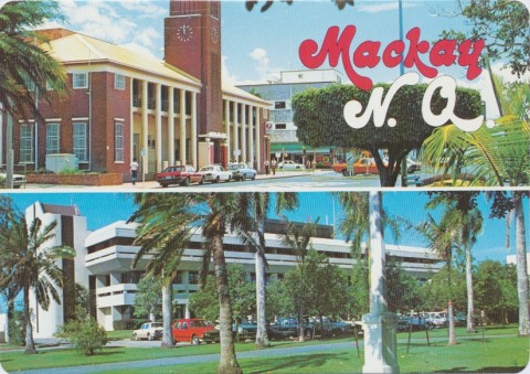
Mackay, a coastal city, is about midway between Rockhampton and Townsville and 820 km north of Brisbane. It grew into a grand city in the 1870s and 1880s with a booming sugar industry. In the 1930s it became Queensland's first regional city to have a town plan when the outer harbour was constructed.
Mackay was named after the explorer John Mackay who led an expedition from Armidale, New South Wales, in search of northern grazing lands. In May 1860, after exploring inland regions, Mackay reached the Pioneer River, upon which the town of Mackay was later established. Mackay named the river after himself, and in 1862 he and a partner took up a pastoral run at Greenmount, 14 km west of Mackay, but the venture did not extend beyond the following year.
Late in 1862 Governor Bowen and Commodore Burnett changed the name of the river to Pioneer, after the vessel in which they travelled, and to avoid confusion with a Mackay River at Rockingham Bay (since renamed Tully River). The following year, to placate the explorer, they named the newly established township on the south bank of the river after him.
MACKAY PLANTOCRACY
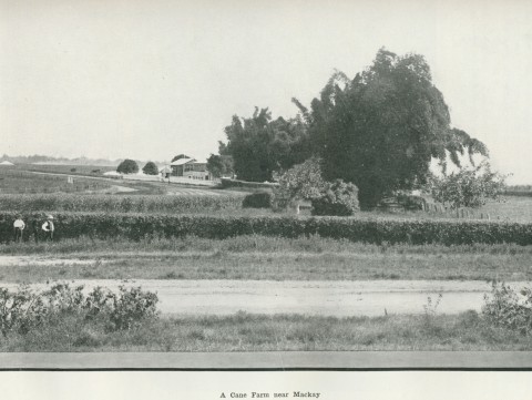
The town survey laid out a grid of streets on a flat area. Around it, the valley was carved up by pastoralists. By 1866 Mackay was connected by telegraph to Brisbane and Bowen, and within a few years had published its first newspaper, built a Catholic church, opened a primary school (1871) and experimented with the first planting of sugar cane. John Spiller, experienced in sugar production in Java, established a small plantation and a home-made mill. Four other plantations followed in the same year, the most successful erecting an iron mill for crushing. By 1874 the Mackay district had sixteen mills, 5000 acres of cane and produced over one-third of Queensland's sugar. A 'plantocracy' displaced the Pioneer Valley pastoralists, the forerunners of the Mackay 'sugaropolis' of the 1880s. Underwriting the extraordinary growth was indentured South Sea Islander labour: by 1877 Mackay took more South Sea Islander labour than any other port, holding that lead for all but one of the next seven years. Sugar acreage trebled between 1879 and 1883, mostly paid for by Melbourne investors.
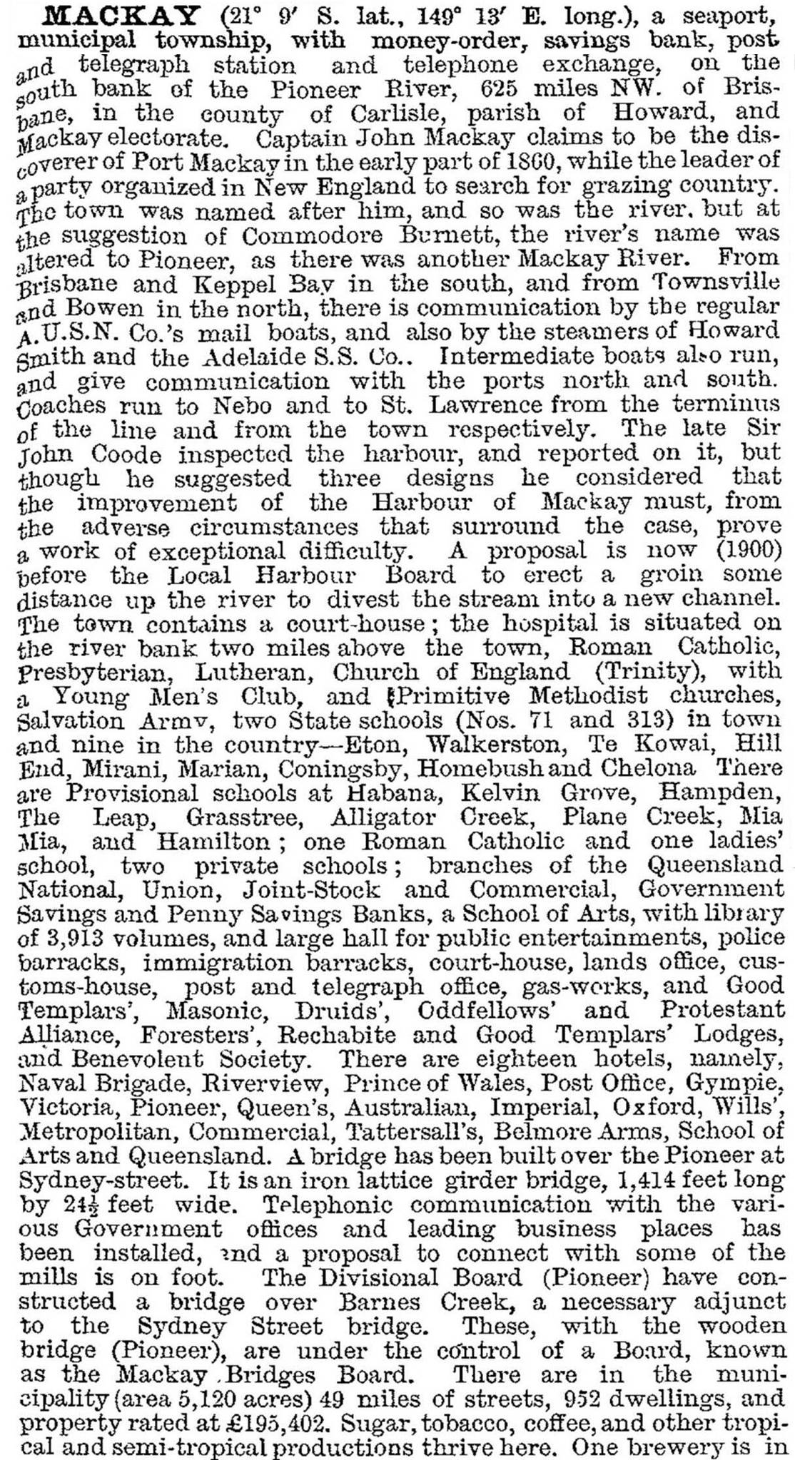
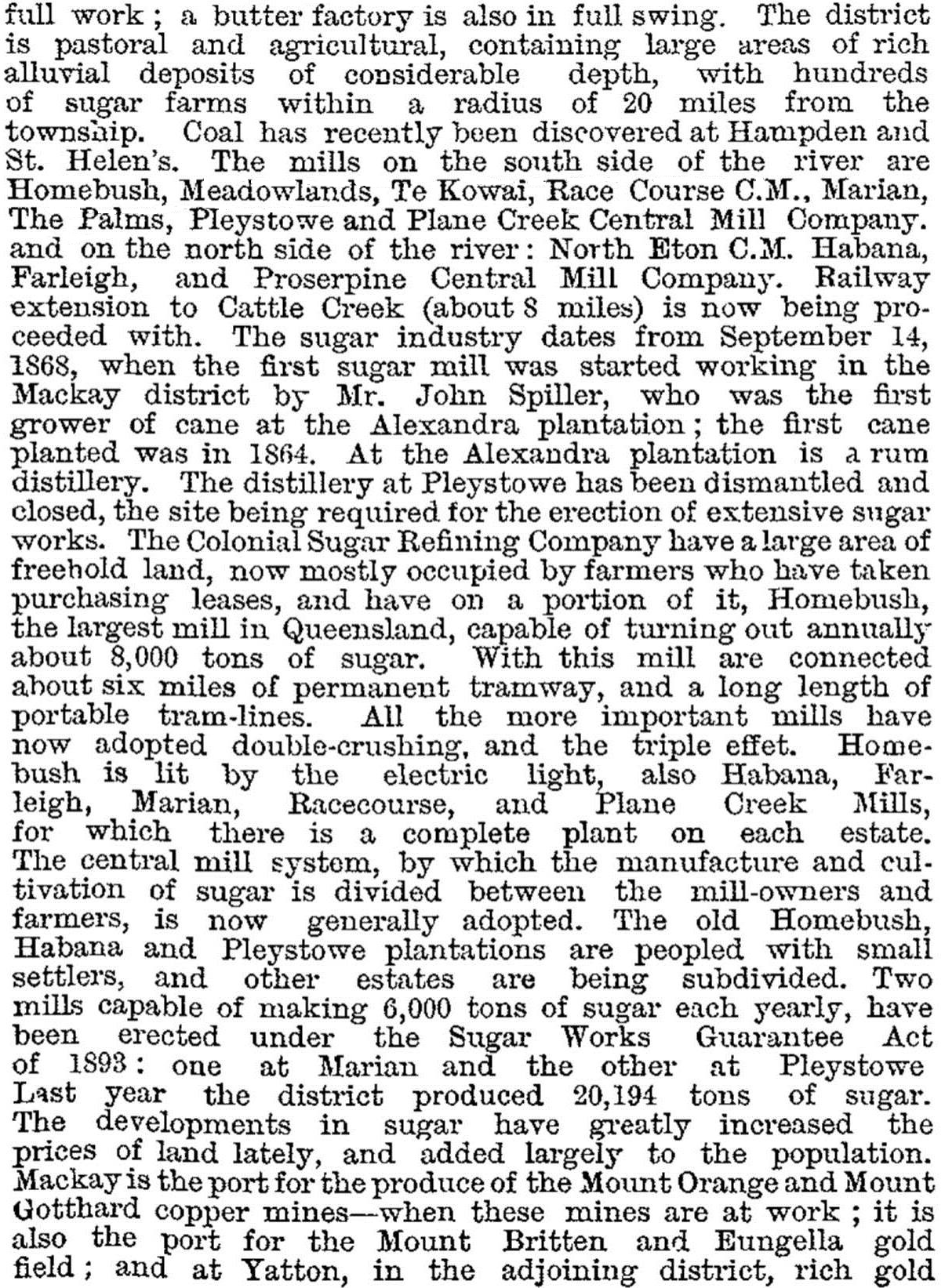
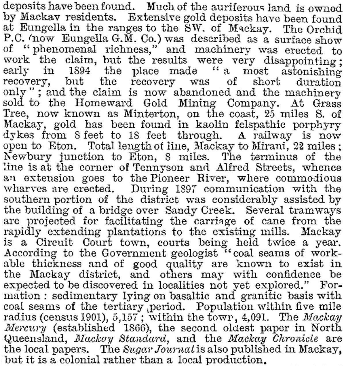
Municipal government began in 1869 and the Mackay township's population tripled during the 1870s. Mackay was described in the Australian Handbook in 1876:

SUGAR INDUSTRY
Several outrages concerning the traffic in indentured labour provoked the colonial government led by Sir Samuel Walker Griffiths to introduce legislation to abolish it. Griffith's initiative coincided with a challenge to Queensland's export market in Britain by subsidised imports from Europe. The abolition legislation encouraged an upsurge in northern separation movements, urging the formation of a new colony. Costs of production were at the root of the trouble. In 1885 Griffith brought forward a proposal for central sugar mills, financed by the government and run on co-operative lines. Selectors would be given a chance against the plantocracy. North Eton and Racecourse central mills were opened in a few years. The move to central mills necessitated rail and tramways to transport cane. John Spiller built a five-kilometre line on his River Estate in 1880, and CSR opened a line at Homebush, south-west of Mackay, in 1883. In 1885-86 government lines from west of Mackay to Eton and Mirani were opened.
TOWN AMENITIES
In the town, an iron Sydney Street bridge over the Pioneer River was opened in 1888. The finest buildings were the post office, the court house and the Joint Stock Bank. The next rank included the Church of England, the girls' State school and the school of arts. Gas was laid on and there were three newspapers. In the absence of a connecting line to the North Coast railway, Mackay was entirely dependent on shipping and the unreliable Pioneer River and sand bar at the mouth for the movement of goods. The government engaged an eminent engineering consultant Sir John Coode, who proposed costly structures to make the river port more accessible. Cyclonic activity, which destroyed many buildings, swept out a new course for the river, and over several decades harbour authorities turned away from the river towards the ocean coastline.
With a population of just over 4000 people, Mackay was described in 1903 in the Australian handbook:
In 1903 Mackay municipality was proclaimed a town. It moved on to City status in 1918. As foreign labour was withdrawn or repatriated from 1901, sugar producers endeavoured to cut down the costs of employing European labour. The Sugar Workers Union amalgamated with the Australian Workers Association in 1910, bringing in experienced minefields union leaders. The ensuing sugar strike, supported by a southern states war chest, was crucial in setting new industrial standards and bringing Labor politics into Mackay. It was fertile ground for a newly-married, labour-oriented Scotsman to begin his political career. The canny William Forgan Smith defeated the non-labour forces in 1915 and represented Mackay continuously until 1942.
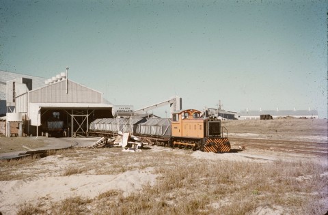
Just before World War I Mackay opened a new town hall and a state high school, along with several commercial premises and two private hospitals. Many of the town's buildings were lost in 1918 when a severe cyclone raged for three days. Thirty lives were lost, 75% of buildings were damaged, and sugar crops and mills were ruined. In that year, coincidentally, Mackay was gazetted a city. Three years later Mackay was connected by rail to Rockhampton and Brisbane, and in 1923 to Townsville. A complex web of lines ran through southern and western Mackay, passing through central station at Boddington Street, and beyond to wharves on the Pioneer River (the lines between the town and Paget Junction were removed in 1993).
PREMIER FORGAN SMITH
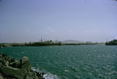
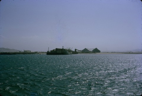
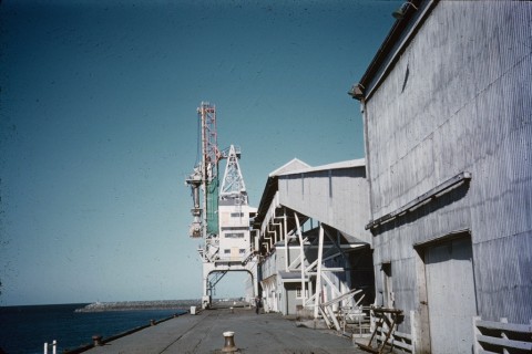
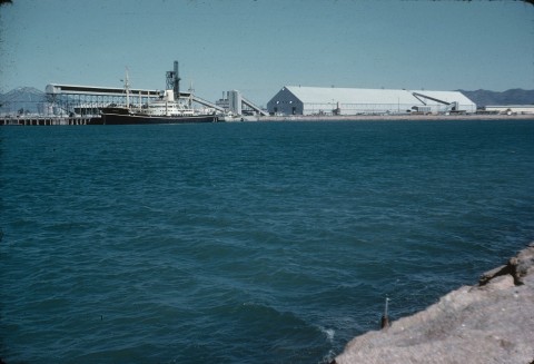
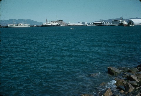
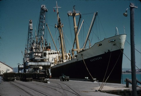
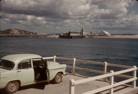
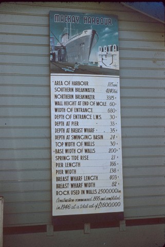
Mackay enjoyed healthy growth during the 1920s but, more remarkably, maintained that growth through most of the 1930s. The main reason was William Forgan Smith. He laid the foundation for the new base hospital in 1921 and secured finances for a new power station which opened in 1936. The new Sydney Street bridge (1938) was named Forgan, and the best appointed cinema in north Queensland, Mackay's Civic, had its plaque unveiled by the Premier in 1940. A skilled politician and pork-barreller, he pushed through finance for Mackay's outer harbour scheme, laid the foundation stone in 1935 and presided at the official opening in 1939. The outer harbour, constructed with stone from the nearby Mount Bassett quarry, proved to be resistant to cyclones.
World War II stopped civic growth and ushered in sugar rationing, as labour shortages sharply curtailed sugar production. In 1946 Mackay, with few buildings more than two storeys high, was described in the Australian Blue Book:
COMMERCIAL SECTOR AND EARLY TOURISM
Several long-established retail businesses dominated Mackay's shopping centre: Marsh and Webster (1875-1984) and Lamberts (1887-2000) department stores were notable examples. Postwar retail expansion reached Mackay when the Brisbane Cash and Carry (BCC) chain opened a supermarket near the town hall. A Big Bear drive-in centre opened in North Mackay in 1964, Mount Pleasant shopping centre, also north of the river in 1980, and Caneland Central, west of the central area, in 1979. Rail access to the city centre ended in 1993.
Despite the changes in retailing, Mackay remained low-rise. Until the early 1970s the only lift in Mackay was at the Mater Hospital. The prominent medium-rise buildings were Queenslander hotels, a monument to Mackay's century of being a 'drinking man's town'. Technological change thinned the ranks of sugar workers, wharf labourers and railway fettlers, and hoteliers adjusted to changing clienteles. The General Gordon in Homebush Road is considered to be the best example of Mackay's surviving heritage hotels, but it is out of the city centre.
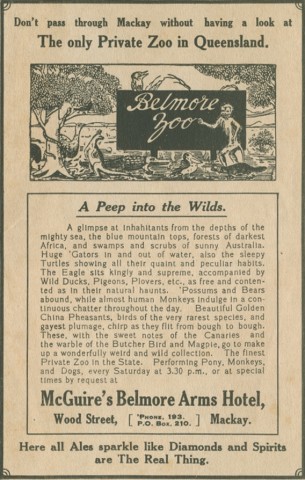
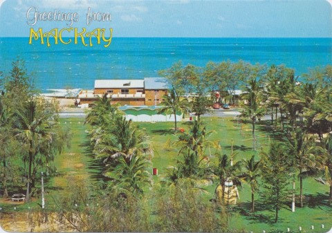
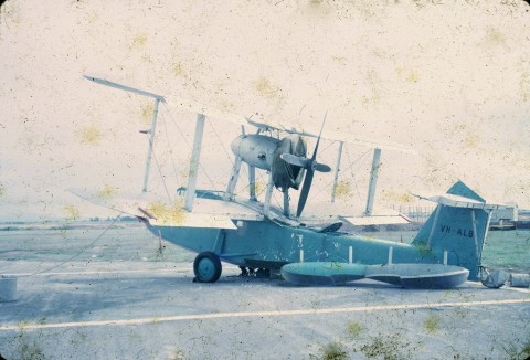
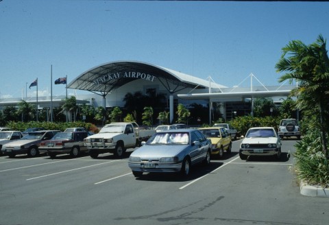
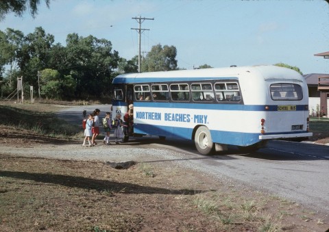
Coastal shipping services and the North Coast railway introduced tourism to north Queensland, and in the 1930s local tourist services began. Ian Wood (Mayor and Commonwealth Senator) started Mackay Tours Ltd, taking visitors to the Whitsunday Islands (Lindeman, Daydream, Hayman etc). He later championed the Mackay aerodrome and the proclamation of the Eungella Ranges national park, west of the city. The Busuttin family started accommodation facilities on Brampton Island in 1933, and the resort was acquired by the local Roylen cruises company in the 1950s. By 1962 Mackay had four motels, a number which increased tenfold by 2000.
HARBOUR FACILITIES AND EDUCATION
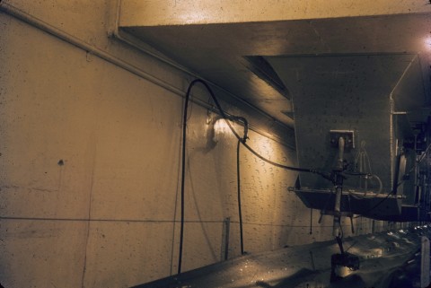
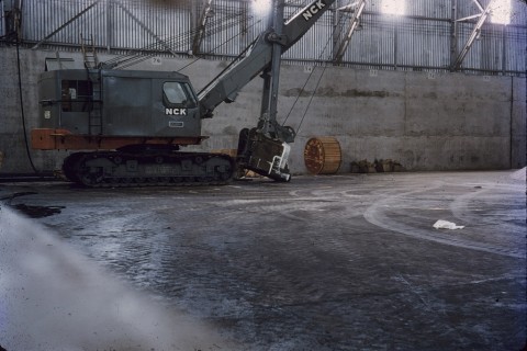
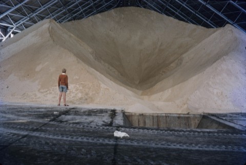
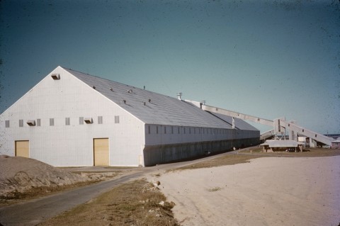
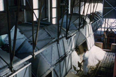
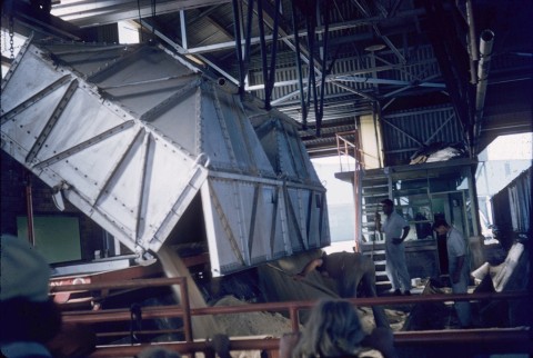
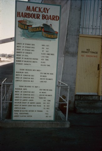
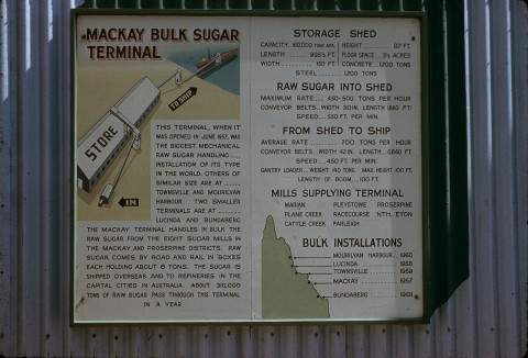
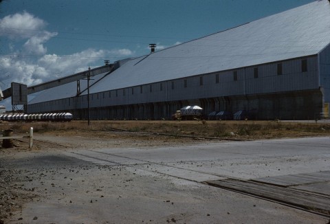
The Mackay outer harbour began converting to bulk loading facilities in 1957 when the sugar terminal was opened. Wharf staff numbers fell from 400 to 80. Bulk storages for fertilizer and chemicals followed in the 1960s, and a bulk grain silo to handle produce railed from Clermont and Capella was opened in 1982. Elsewhere, at Hay Point, an export coal port was built in 1971 for the open-cut mines at Goonyella, 150 km south-west.
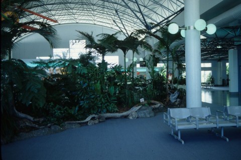
Tertiary education was provided at the Resource Centre established by the University of Queensland in 1963 with ownership being transferred to the James Cook University in 1991. In 1992 the Central Queensland University, based at Rockhampton, opened a comprehensive campus in Mackay. An Entertainment Centre, jointly built by Mackay City and Pioneer Shire Councils, opened in 1988. This venture anticipated the amalgamation of the councils in 1994, by which Mackay's area increased from 21 to 2820 sq km.
URBAN SPRAWL AND HERITAGE
In the 1960s suburban Mackay spread beyond the city's municipal boundaries into Pioneer Shire and by 1991 greater Mackay's estimated population exceeded 40,000, compared with 23,000 in the municipal city. By 2001 greater Mackay approached 60,000 people. An urban population of this order partly explains the changes in retailing, as chain hardware, furniture and discount department stores are drawn to outer suburban drive-ins and older name local firms left in the centre fall on hard times. Lamberts, part of a small Centrepoint shopping complex in the city closed in 2000. Marsh and Websters became a David Jones outlet, but subsequently failed.
By 2005 the City Council turned its attention to inner city revitalisation, beginning with the river and wharves. The Bluewater Lagoon in Caneland Park on River Street was completed in 2008, providing three swimming pools.
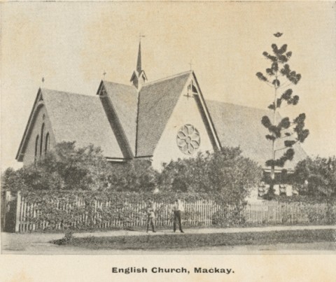
Mackay retains several heritage buildings, the old Customs House near the river, the former town hall and the post office. The former Australian Joint Stock (later Commonwealth) Bank a few doors east in Victoria Street is Mackay's grandest building and is on the Australian heritage register. Other heritage-listed sites include the former technical college (1912) and central school (1933) in Alfred Street, the Uniting (former Presbyterian) church (1898-1918) in MacAlister Street, the Holy Trinity Church of England complex in Gordon Street, the court house (1880s), and police station (1930s) in Victoria Street. Pioneer Shire's art deco offices in Wood Street are also heritage-listed.
Population census data for Mackay has been:
| Census Date | Population |
|---|---|
| 1871 | 729 |
| 1881 | 2075 |
| 1891 | 3597 |
| 1911 | 5141 |
| 1933 | 10,665 |
| 1954 | 14,762 |
| 1961 | 16,809 |
Thereafter:
| Census Date | Urban Mackay | Mackay City Municipality |
|---|---|---|
| 1966 | 18,646 | 24,578 |
| 1976 | 20,224 | 31,522 |
| 1986 | 22,199 | 38,603 |
| 19961 | 71,894 | 44,880 |
| 20011 | 72,998 | 57,649 |
| 20061 | 84,856 | 73,0912 |
| 2011 | 77,293 | 74,219 |
1Amalgamated with former Pioneer Shire
2Preliminary figure.
During the mining boom of 2004-06 the population of urban Mackay grew by 2.5-3.5% annually and Mackay had the worst housing shortage of any major Queensland city. In 2008 the showgrounds were given over to a new State Government Urban Land Council for more housing. In 2008 Mackay City (2820 sq km) was amalgamated with Mirani and Sarina Shires to form Mackay Regional Council. Its area is 7621 sq km and its census populations have been:
| census date | population |
|---|---|
| 2006* | 100,260 |
| 2011 | 112,798 |
*estimated
John Elliott, Mackay 1988: a bicentennial portrait, Mackay, Boolarong for Mackay District Cane Growers' Executive, 1988
Martin Hislop et al., eds, Sweet settlement, Rockhampton, Central Queensland University Press, 1995
K.H. Kennedy, Mackay revisited, Mackay, Mackay City Council, 2002
H.A. Moore, The Mackay harbour story, Mackay, Mackay Harbour Board in association with Rigby, 1978
H. Ling Roth, The discovery and settlement of Port Mackay, Queensland, Halifax, England, King & Sons, 1908
Andergrove, Bakers Creek, Ball Bay, Beaconsfield, Blacks Beach, Bucasia, East Mackay, Eimeo, Eton, Farleigh, Glenella, Habana, Homebush, Kuttabul, Marian, Midge Point, Mount Pleasant, North Mackay, Ooralea, Pioneer Shire, Pleystowe, Racecourse, Rural View, Seaforth, Shoal Point, Slade Point, South Mackay, Walkerston, West Mackay and Mackay Regional Council entries