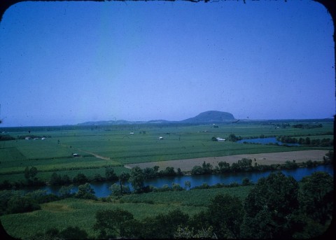
Maroochy River is a rural/residential locality immediately east of Yandina, extending for seven km to Bli Bli. It is also seven km west of the Maroochydore airport. The locality is on the north and south sides of the Maroochy River. It is thought that the river's name derived from an Aboriginal expression describing the red bill of the Australian black swan.
The Maroochy River was navigable almost to Yandina, which was the district's principal place of settlement. Lake Dunethin and Dunethin Rock were a convenient place for loading and unloading from boats, and downstream from there the land was flood prone. Dunethin Rock or thereabouts was the site of the Maroochy River primary school (1911-72) and the school of arts hall (1914). The Maroochy River locality, however, was regarded as an outlying part of Yandina.
Dunethin Rock was also a depot for sugar cane grown north of the river, until the Moreton central mill in Nambour extended the cane-train network with a bridge over the river in the 1930s. Since the closure of the Nambour mill, cane growers have gone into producing cow-candy fodder.
Maroochy River has rural/residential areas south of Dunethin Rock, where there is also a scout camp. Its census populations have been:
| Census Date | Population |
|---|---|
| 1911 | 135 |
| 1921 | 314 |
| 1961 | 305 |
| 2006 | 1622 |
| 2011 | 1337 |