Nambour, a town, is 90 km north of central Brisbane and 12 km inland from Maroochydore. It is on Petrie Creek, and until 1890 was known by that name. 'Nambour', or possibly 'Nambah' was the name of a farm taken up by William Samwell in the early 1870s, and it is thought that the name was derived from an Aboriginal word describing tea-tree bark.
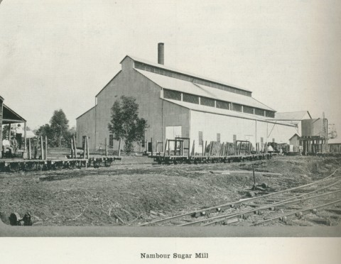
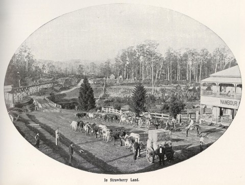
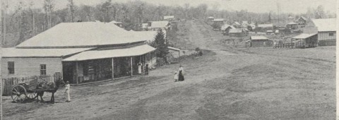
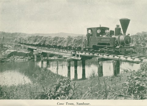
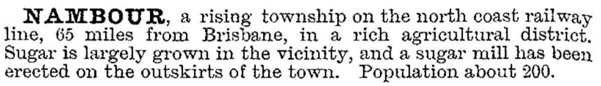
Until recently Nambour was situated in a sugar-growing region but, in the 1880s-90s it had a mixed rural economy - bananas, timber harvesting, corn, fruit and as much sugar as could be processed by the limited local facilities. Flooding and financial depression set back most of those industries, and a strategic decision was made by the colonial parliament to build a large central mill to process enlarged sugar cane plantings. The Moreton Central Sugar Mill – central to Yandina, Petrie Creek and Bli Bli – was opened at Nambour in 1897. Four years later cane tramways were built and in 1907 locomotives were installed to transport cane to the mill. After the Maroochy local government division was formed in 1890 by severance from Caboolture and Widgee Shires, Nambour was chosen as the administrative centre. Nambour's first church, St Joseph's Catholic, was also opened in 1890. The railway through Nambour was opened in 1891. A further indication of Nambour's central importance came with the publication of the Maroochy district's Nambour Chronicle in 1903. That year Nambour was also briefly described as a rising township in the Australian handbook:
Pugh's Queensland Directory (1905) recorded Catholic, Methodist and Anglican churches, the Salvation Army, several shops and stores, trades people and builders and even a music teacher in Nambour. The 1925 directory showed that services to polite society had increased from two drapers to eight, tailors from nil to two and hairdressers from nil to two; conviviality's interests had increased from two hotels to four. When the town hall burnt down in 1929 it was replaced by a large brick and concrete edifice with silky-oak fittings and an auditorium with 650 seats and an electric sound system.
The 1920s was a time of commercial growth in Nambour: a chamber of commerce started in 1920, a pineapple cannery, an electricity reticulation scheme and several new sawmills. The decade ended with the opening of a district hospital, actively supported by lodges and friendly societies in a predominantly Protestant town.
In the 1950s economic activity in the Maroochy district began to move to beach towns, and the opening of the David Low coast road in the 1960s accelerated that process. Nevertheless, there was a spill over to Nambour as many of its old timber buildings were replaced by new brick structures, including a town hall (1960), and new municipal offices (1978) to cope with a greatly enlarged population.
On three occasions the Maroochy Shire offices have been damaged or destroyed by fire. The present civic hall and associated square date from the early 1990s.
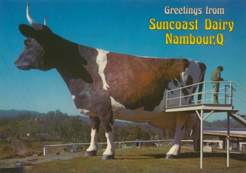
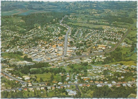
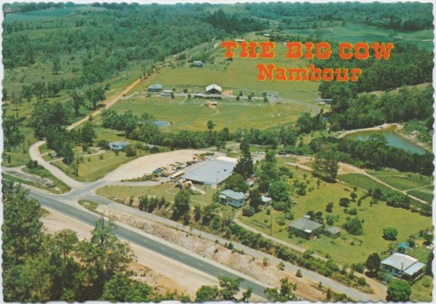
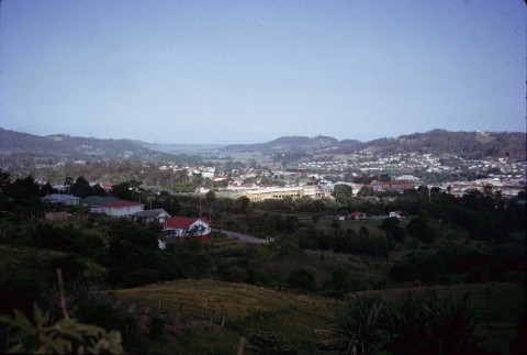
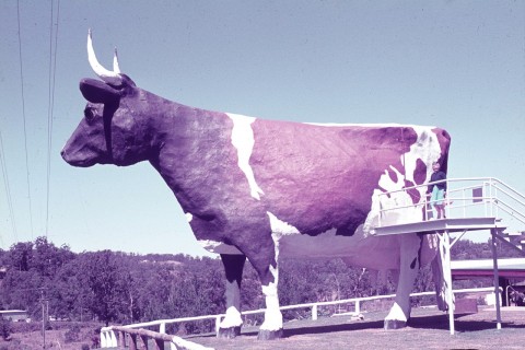
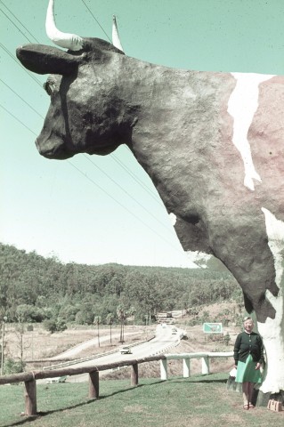
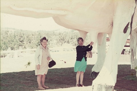
Nambour's population nearly doubled between 1966 and 1996, to about 12,000. It was not the same as the spectacular growth of beachfront Maroochydore, but the population result was nearly the same. The economic base was less dependent on tourism, although the Big Pineapple a few kilometres away at Woombye was one of Australia's most visited sites. The sugar mill closed in 2003, ending the era when cane trams trundled across the main street.
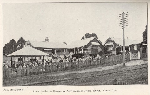
Nambour has two hospitals, two state primary and high schools (including those in neighbouring Burnside), a Catholic primary school (1925), Nambour Christian College (1980), two independent secondary colleges in neighbouring Burnside, a QUT campus and a combined sports ground, a golf course and showground (1909). The twenty-sixth Prime Minister of Australia, Kevin Rudd (December 2007-June 2010, June-September 2013) and Wayne Swan (Deputy Prime Minister June 2010-June 2013) both attended Nambour State high school.
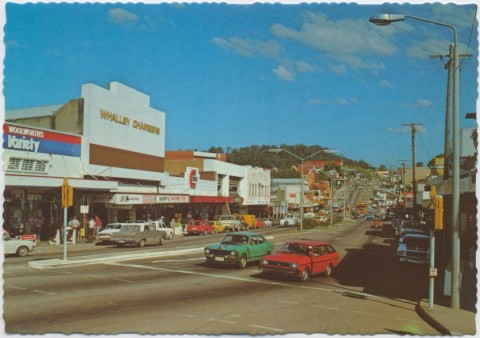
Currie and Howard Streets have a long strip of shopping centres, and Howard Street ends with Nambour Plaza drive-in shopping centre with a discount department store, a supermarket and 38 shops. Nambour's census populations have been :
| Census Date | Population |
|---|---|
| 1901 | 274 |
| 1911 | 1150 |
| 1933 | 2251 |
| 1954 | 4678 |
| 1976 | 7435 |
| 2001 | *12,822 |
| 2006 | *13,537 |
| 2011 | 10,221 |
* Includes Burnside and Coes Creek.
A. Blyth and B. Want, Pictorial history of Nambour, Sunshine Coast, Nambour and District Historical Museum Association Inc, 2008
B. Alcorn and R. Dunn, Moreton sugar mill - sweet heart of Nambour, Nambour, the authors, 1997
Sarah Morgan, The shop window: celebrating 10 years of the Sunshine Coast Show, the author, 2005
Helen Gregory, Making Maroochy: a history of the land, the people and the shire, Brisbane, Boolarong with Maroochy Shire Council, 1991
Ray Kerkhove, Aboriginal Nambour, Nambour, Interactive Community Planning, 2009
Burnside and Coes Creek entries