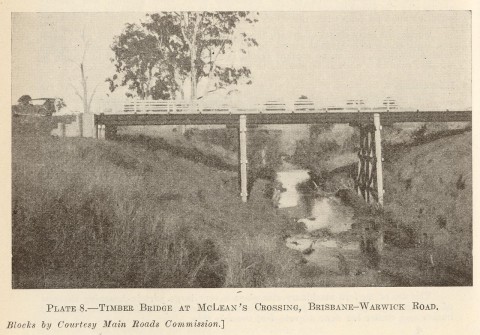
North and South Maclean are rural suburbs on the Logan River between Greenbank and Jimboomba, 35 km south of central Brisbane. They are on the Beaudesert Road, and the Maclean Bridge (c1862) was the first one built over the Logan River. The Maclean township was surveyed about a year after the bridge was opened.
Maclean was most probably 'McLean' when first named. Alexander McLean was a New South Wales surveyor (1856-61), and census records listed populations for 'McLean' in the early twentieth century. When the bridge was duplicated by a higher timber structure in 1876 the name Maclean was quite likely given to it, as Peter Maclean was a Beenleigh dairy farmer who was elected the Logan MLA in 1876.
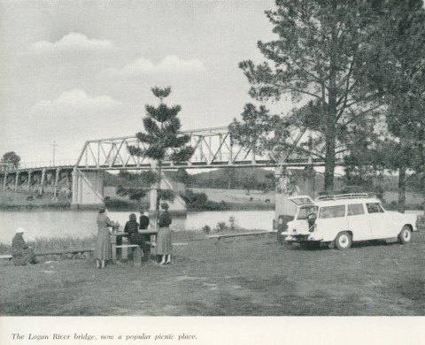
Maclean did not develop as a town. The ferry at Waterford and the Loganholme bridge at Beenleigh carried more traffic. A third bridge was built at Maclean in 1934, and the second one was washed away in 1947. There are riverside parks near the bridge.
South Maclean's rural acreages are promoted as being among the few horse-friendly areas in Logan City. Until 2008 North and South Maclean were in Beaudesert Shire.
| Census Date | Population | ||
|---|---|---|---|
| McLean/Maclean | South Maclean | North Maclean | |
| 1911 | 121 | ||
| 1947 | 51 | ||
| 2006 | 1222 | 1575 | |
| 2011 | 1255 | 1541 | |