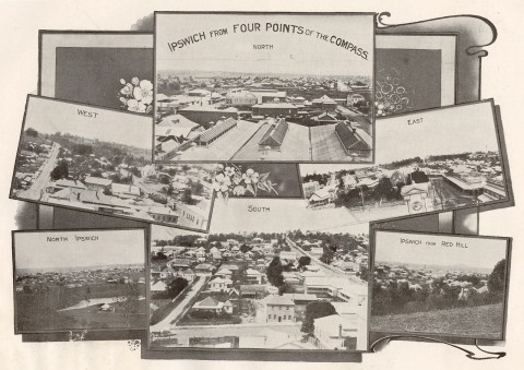
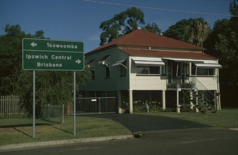
North Ipswich lies in a U-shaped bend of the Bremer River, immediately north of Ipswich central. It extends north to beyond the Warrego Highway, which includes part of the former suburb of Raymonds Hill. The boundary between the two lay along W.M. Hughes and Wyndham Streets, just north of the North Ipswich railway workshops.
Railways
In 1860 a floating bridge across the Bremer River to North Ipswich was installed and four years later a site west of The Terrace was chosen for the assembly of the rolling stock for Queensland's first railway. Trains first ran in July 1865 from Ipswich to Grandchester. In 1867 the North Ipswich primary school was opened.
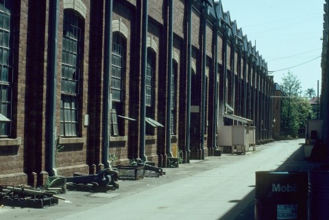
The railways became North Ipswich's dominant industry and improved brick workshops were built further north in 1885. Around the 1900s the original workshops were replaced by a powerhouse, and a branch railway line was run north to the Tivoli coal mines (1898). The full array of facilities included a sawmill, wood machining, forging, assembly, painting, electrical, brake and bogie maintenance, blacksmithing and stores.
Other Industries
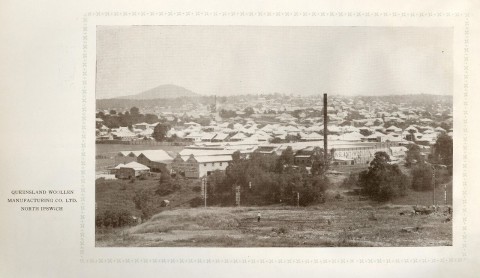
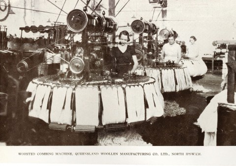
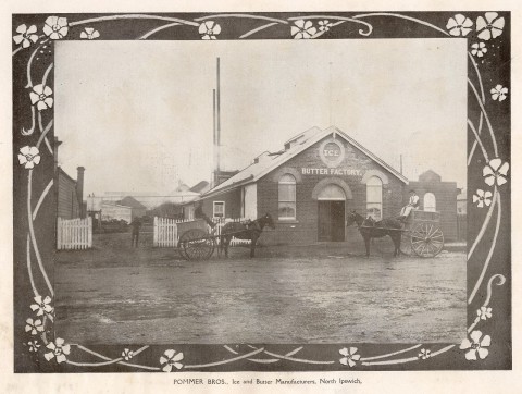
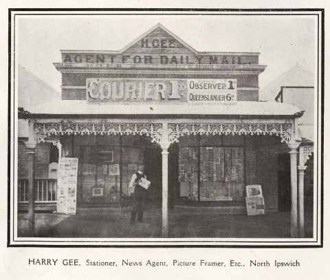
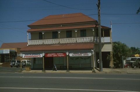
The workshops site and rolling stock yards flanking the western side of North Ipswich took up about one-third of the suburb. Elsewhere in North Ipswich there were the Queensland Woollen Manufacturing Co (1877) at 42 The Terrace, near Lamington Street, the Ipswich Gas and Coke Co (1878) at 8 The Terrace and the Ice and Butter Factory (1897) at 9 The Terrace. The Railways administration building was at the western end of The Terrace. Workers' houses were built east of the workshops, around the primary school. St Thomas' Church of England (c1889) is opposite the school and nearby Lennon Lane contains several workers' cottages dating from the 1890s. A block or two to the south is Browns Park, a neighbourhood reserve on a plateau planted with well established trees. Further afield on the river's edge there are North Ipswich and Cribb Parks. North Ipswich's commercial thoroughfare, Downs Street, had shops and businesses serving local needs. They included three boot repairers, two butchers, two grocers, four mixed businesses, a newsagent, two hotels and the Rialto cinema (post office directory, 1949). There were also Congregational, Methodist (1880) and Presbyterian churches in Downs Street.
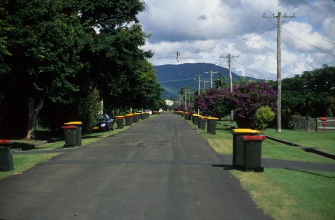
North of the workshops the landscape rises along Pine Mountain and Waterworks Roads to Raymonds Hill (a locality in North Ipswich, formerly a separate suburb). On the western side of the hill is St Joseph's Catholic church and school (1913). Houses sit on larger blocks, and several intact precincts survive in Hill and Liverpool Streets, and along nearly the entire stretch of Pine Mountain-Waterworks Roads from Wyndham Street to Holdsworth Street, near the Warrego Highway.
In 1915 the railway workshops employed 1600 men, 9% of Ipswich's population. Employment rose to 3300, 33% of the population, in the late 1940s. During the war munitions were manufactured there. In 1965 workshop functions were slowly transferred to a new site at Redbank, and the process was completed by the 1990s. The visually impressive roundhouse (train storage shed) was demolished, but other buildings were kept for railway heritage.
Some of Ipswich's earliest heritage sites are found in North Ipswich. The remains of river wharves (1847) are on the Bremer Street side of the river. Nearby is a railway bridge and abutments (1865, 1915) which lead to an overpass at Heiner Road (1864) and the North Ipswich railway workshops (1878). Between the overpass and the workshops there is the Hotel Cecil (1887) at the corner of Downs and Lowry Streets.
The Gas and Coke Co's site at The Terrace, adjoining the railway line, was redeveloped as a drive-in shopping centre, Riverlink (2007), with bulky-goods stores, three discount-department stores and over 100 outlets.
In January 2011 the Bremer River flooded into North Ipswich on three sides. Whilst some of the flood-prone land had been kept as open space, notable casualties were the Riverlink shopping centre, the David Trumpy bridge and Cribb Park with adjacent houses.
The census populations of North Ipswich have been:
| census date | population |
|---|---|
| 2006 | 4273 |
| 2011 | 4587 |
Robyn Buchanan, Final gauge: the history of the Ipswich Railway Workshops, Ipswich, Ipswich City Council, 1996