North Rockhampton, once the poor relation of Rockhampton on the opposite side of the Fitzroy River, overtook Rockhampton in terms of population during the 1970s. It provided the only natural growth space as Rockhampton's built-up area reached the limits of land above the flood level.
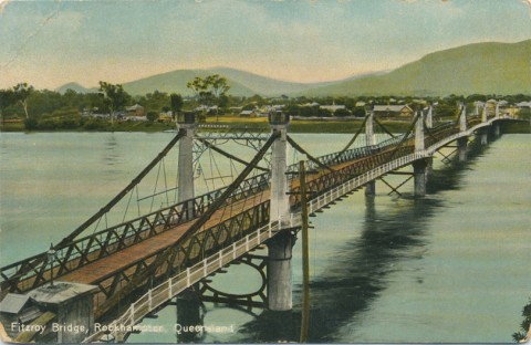
The Fitzroy River bridge, an iron, cable-supported structure, was opened in 1881, changing North Rockhampton from a refuge for the very poor to a place where battling do-it-yourselfers could succeed. Land prices increased, until the place was invaded by prickly pear. Poisoning and constant cultivation combated the pest. In 1883 North Rockhampton had been detached from the Gogango local goverment division and proclaimed a municipality, and a borough hall (1885) was built in Stapleton Park just beyond the bridge.
In 1888 a railway line was opened from North Rockhampton to Emu Park, permitting Rockhampton's inhabitants to take a ferry across the river and escape from the inland heat to their coastal watering place. When a railway bridge was built in 1899 it provided a through railway for inland livestock to the Lake Creek meat processing works (1871), a few kilometres downstream from North Rockhampton. The train rattled past the Callaghan Park racecourse, over the road from the North Rockhampton railway station. Dr William Callaghan, coroner and district medical officer, was a keen horseman and supporter of the Jockey Club. When the club transferred its course to North Rockhampton in 1898 it was named after the doctor.
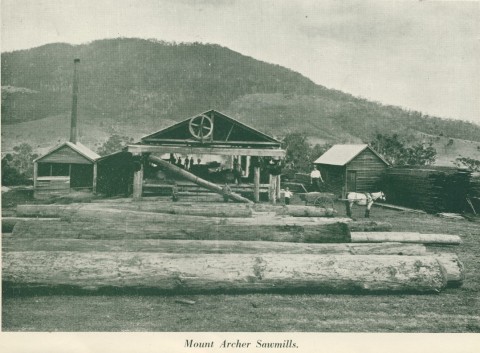
North Rockhampton was amalgamated with the south-side city in 1919, its population over the 3000 mark. Pugh's Queensland Directory (1924) recorded six hotels, plus others at Kalka, Koongal and Lakes Creek, three blacksmiths, two sawmills, a bedding manufacturer and numerous grocers and storekeepers. The Berserker Street State primary school had opened in 1917. The place was still known as the borough of goats and prickly pear until the 1930s when cactoblastis did its work and re-invigorated land prices.
New suburbs emerged after World War II, and they are mentioned below under further reading. Frenchman's Creek's name was changed to Frenchville in 1925, and in the 1970s became a fashionable suburb climbing into Mount Archer's foothills. It was named after the botanist, Anthelme Thozet, who had an experimental garden at Kalka. In the opposite direction an Institute of Advanced Education was started in 1967 on the Bruce Highway across the road from the Parkhurst industrial estate. It was upgraded to the Central Queensland University in 1989.
Lacking Rockhampton's heritage sites, there are fewer features to list. Mount Archer has a fine lookout, and the Dreamtime Cultural Centre (1988) opposite the turn-off to Yeppoon is a notable Indigenous centre. The restored borough hall is a reminder of the past, and perhaps most potent of those reminders is the Kanaka-financed single-skin timber and fibro St John's Church of England (1912) in Ford Street. It looks across Moore's Creek to Rockhampton Shopping Fair (1985). Both the borough hall and the chapel are listed on the Queensland heritage register.
FLOODS 2011
In early January 2011 houses from Brown Street to High Street in Berserker were flooded as water backed up Moores Creek from the Fitzroy River. On the river’s edge, Stapleton Park and surrounds were also under water. At Frenchmans Creek flooding was extensive, extending upstream to Elphinstone Street, and McLeod Park was nearly all under water.
North Rockhampton's census populations were:
| Census Date | Population |
|---|---|
| 1871 | 433 |
| 1891 | 1751 |
| 1911 | 2833 |
Lorna McDonald, Rockhampton: a history of city and district, Rockhampton, Rockhampton City Council, 1995
Frenchville, Lakes Creek and Park Avenue entries