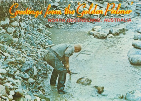
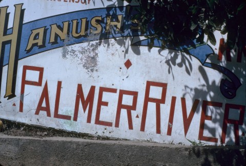
The Palmer River goldfield, comprising the river and several of its tributaries, is 140 km south-west of Cooktown. The river's headwaters are on the western side of the Daintree National Park and run toward the Gulf of Carpentaria. There were numerous settlements and townships including (travelling from west to east) Palmerville, Maytown, Idatown and Byerstown. Palmerville was superseded by Maytown as the district's administrative centre.
In 1872 the pastoralist-explorers William and Frank Hann were commissioned by the Queensland Government to explore Cape York. They reported finding traces of gold on the Palmer River and the following year James Mulligan, an experienced prospector, confirmed plentiful alluvial gold. A rush began, with prospectors overlanding form the Etheridge goldfield or from the Endeavour River inlet where Cooktown had sprung up in a few months.
GOLD
From Cooktown there were several tracks to the goldfield, all in an anti-clockwise arc. A shortcut to Maytown involved passing through a narrow rocky gorge which became known as Hells Gate. It proved to be a dangerous place of ambush as Aborigines took revenge or resisted invasion by the European miners. As Chinese miners entered Cooktown, they too were ambushed.
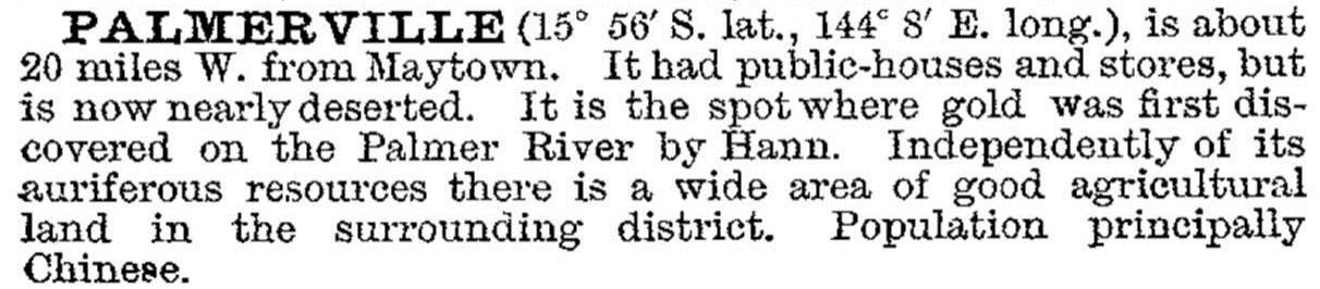
The Palmer River was named after Arthur Palmer, Premier of Queensland (1870-74), who commissioned the Hann brothers' exploration. The first rudimentary settlement on the goldfield was the westernmost Palmerville (at first named Palmerston). In 1883 the Australian handbook stated that the town had two hotels, two stores and a population of about 50 Chinese. By contrast, the 1881 census recorded a population of 731. By 1903 the Australian handbook reported its desertion:
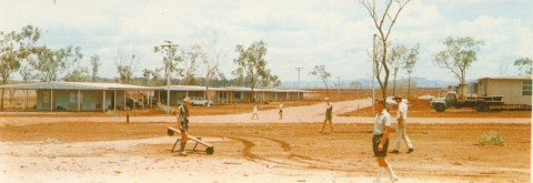
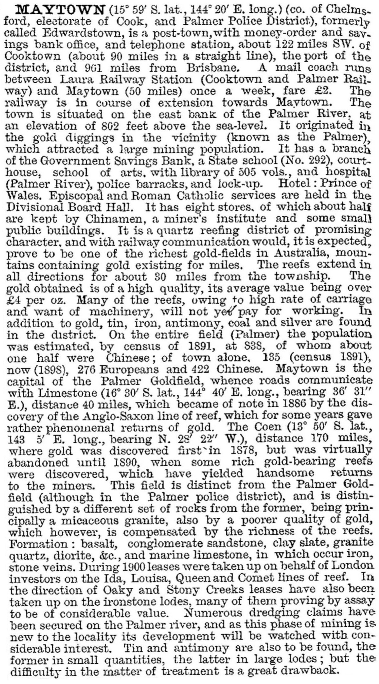
Maytown, about 25 km east of Palmerville, began as a camp in late 1873 as miners worked upstream. Named Edwardston, after Jack Edwards who brought in livestock for fresh meat, it was renamed Maytown by the local mining warden, Phillip Sellheim in 1874. For several years many buildings were roughly run up from bush timber and bark, but in 1879 it was made the administrative centre of the Hann local government division. The Australian handbook (1883) recorded three banks, a school of arts with a library of 223 volumes, a hospital, several hotels, two chemists and numerous stores, about half with Chinese proprietors. The Handbook put the population in 1881 at about 5000, whereas the census recorded 1104. Later Handbooks mentioned a school, a courthouse and a miners' institute. Maytown was described fully in the 1903 Australian handbook:
Church services were held in the divisional board's hall. The last inhabitants who lived in the post office, left in 1950, 25 years after the school closed. Visible relics include kerbing and flagstones of the former main (Leslie) street and the coach road out of Maytown to Laura. Maytown's census populations were:
| Census Date | Population |
|---|---|
| 1881 | 1104 |
| 1891 | 135 |
| 1901 | 273 |
| 1911 | 55 |
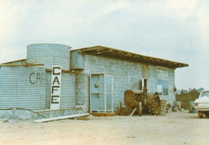
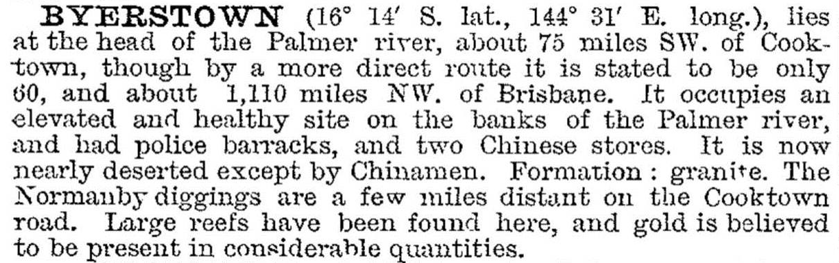
Byerstown, 75 km east of Palmerville, occupied an elevated and healthy site on the Palmer River. In 1882 the Australian Handbook recorded four hotels, 13 stores, a police barracks, two butchers and a blacksmith. Described as the emporium for the Palmer Goldfield, it was estimated that three-quarters of goods consumed passed through Byerstown. By 1903 Byerstown was reduced to two Chinese stores. Its census population in 1881 was 701, and nothing was recorded in later censuses, until 1933 when 263 people were counted, many of whom were unemployed because of the Great Depression.
Byerstown was described in the 1903 Australian handbook:
The Palmer River Goldfield was succinctly portrayed in the 1876 Handbook both as to its prospects and social conditions:


Many miners decamped to the Hodgkinson goldfield (proclaimed in July 1876) centred on Thornborough, 120 km south of Byerstown, but it yielded less than one-sixth of the Palmer's gold. Its discovery lured many Europeans away from the Palmer, leaving alluvial work to industrious Chinese miners. Plans for reef mining were abandoned as skilled miners moved south, while isolation and the high costs of transport had also taken a toll on the settlement. By 1892 the entire population of the once bustling field numbered just over 1000. Drilling tests in the 1920s and dredging were tried and abandoned. A mining historian in 1980 described the Palmer, for most of its time, as a socially debilitating region, and a hellish sink for misdirected and hard-won capital in its reefing phase.
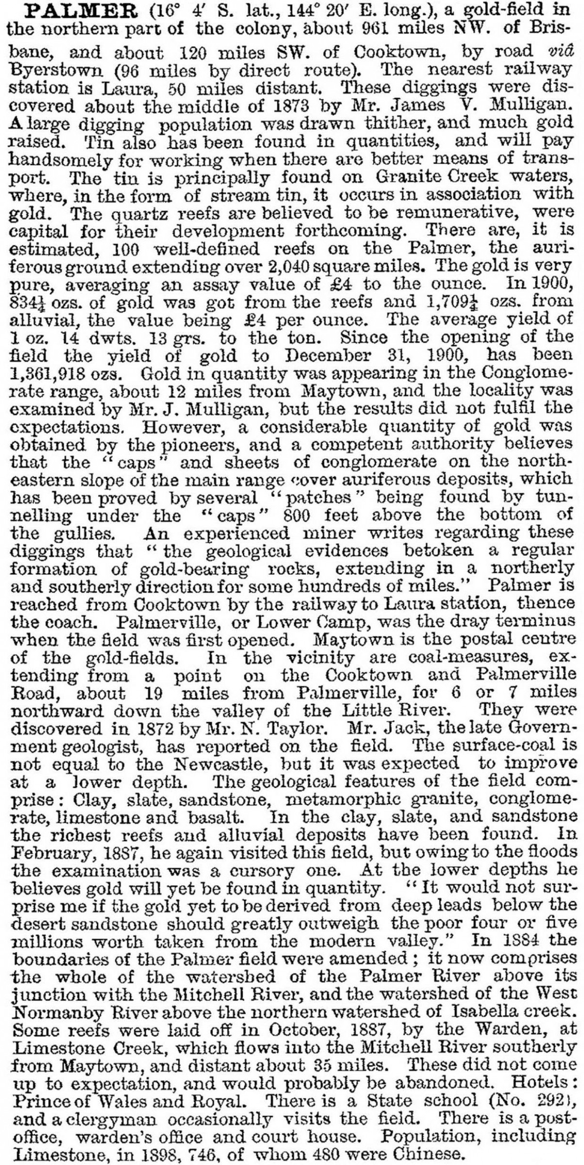
The Palmer goldfields were described in the 1903 Australian handbook:
The Palmer River Goldfield – 'Four Deep Mines' – at Maytown is listed on the Australian heritage register.
Frank Dempsey, Old mining towns of North Queensland, Adelaide, Rigby, 1980
Hector Holthouse, River of gold: the story of the Palmer River gold rush, Sydney, Angus & Robertson, 1967
N. Kirkman, 'The Palmer River goldfield' in K.H. Kennedy, ed, Readings in North Queensland mining history, vol. 1, Townsville, History Department, James Cook University, 1980
Glenville Pike, Queen of the north: a pictorial history of Cooktown and Cape York Peninsula, Mareeba, Pinevale, 1979
Ron and Viv Moon, Cape York: an adventurer's guide, Pearcedale, Vic, Moon Adventure Publications, 2008