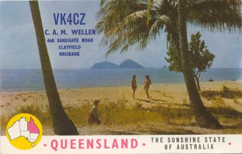
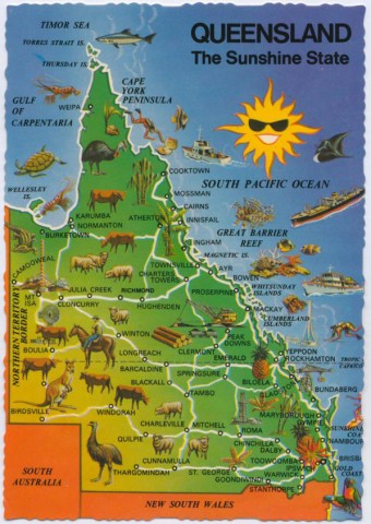
Queensland, the north-eastern state of Australia, has an area of 1,727,000 sq km, 22.5% of the Australian land surface. Its southern border adjoins New South Wales, and about 2100 km distant its northern border in the Torres Strait nearly touches Papua New Guinea. Its maximum east-west distance from near Maryborough to the Northern Territory is 1450 km. A little over half of Queensland is classified as tropical.
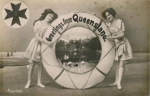
The earliest European settlement was at the south-east coastal corner, around Moreton Bay (1824). At first a penal colony, it was known as Moreton Bay until it achieved separation from New South Wales in 1859. The first Governor, Sir George Bowen, announced that the name 'Queensland' was 'entirely the happy thought and inspiration of Her Majesty', Queen Victoria.
A dividing range runs unevenly from the New South Wales border to north of Cairns. The prominent parts are: the McPherson Range, south of Beechmont; the Carnarvon Range, a sprawling land mass east of Blackall; the Gregory Range, south of Georgetown; lesser ranges on the Atherton Tableland and west of Port Douglas; and lower ranges in a broken skein as far north as Lockhart River. Around Gregory Range, the uplands have an east-west extent of 400 km, and greater around the Carnarvon Range. There is another upland around Mount Isa and Cloncurry. Despite these extensive uplands there remains much country that is undulating or flat. The Channel Country in the south-west of Queensland is noted for meandering watercourses that can divide into braided distributaries at flood time.
CLIMATE
With its long coastline Queensland has a high variability in its climate, from a warm temperate south to a tropical north. The coastal dividing range causes further variability as one moves inland. The coastal strip has average annual rains of 1000-1600 mm in the south to over 3000 mm around Innisfail; west of the dividing range rainfall averages 700 mm (Dalby) to 215 mm (Birdsville). Queensland has a wet-Summer, dry-Winter rain pattern.
Variability is further accentuated by alternating El Nino and La Nina weather patterns. The El Nino weather is characterised by low-moisture trade winds from the Pacific, and the effect can last for a year or for more than five. Drought conditions follow, notably c1895-1902 (federation drought) and c1937-46. There were briefer droughts in the 1990s and a longer one during 2001-08, considered to be more severe than the federation drought.
La Nina brings moisture-laden trade winds, often with cyclones and floods. The cyclones can cross the Queensland coast at any point – Cooktown (1899), Mackay, Mission Beach (1918) and Gold Coast (1954). Cyclone Wanda flooded Brisbane in 1974.
Cyclone Yasi in 2011 was one of Queensland’s most serious disasters. However, it was not an isolated event but came amidst a very strong La Nina. There was heavy rain in Queensland beginning in August 2010, producing the wettest Spring since 1900, nearly triple average rainfall. Thirty per cent of Queensland (south-west, central interior, central and tropical coasts, and adjacent inland) had the highest rain on record. Nearly 70% of Queensland had ‘very much above average’ rain. Major rainfalls in January 2011 on sodden landscapes caused rivers to rise and, in some cases, flash-flood. Brisbane had a repeat of its 1893 and 1974 events. The flood-mitigating Wivenhoe Dam was handicapped by having all its water supply and a substantial part of its flood-water containment filled when the inundation came; in any case 50% of the Brisbane River catchment is below Wivenhoe. There were also floods in country towns.
Cyclone Yasi struck just after midnight on 3 February 2011, centred on Cardwell and Tully. Its Category 5 effects were felt in Cairns and Townsville. By 10pm it had become a tropical low over Mount Isa. The La Nina event is independent of climate change, although climate change probably influenced the intensity of the rainfall and cyclones.
PASTORALISM AND ABORIGINES
Leaving aside Moreton Bay's penal origin, European settlement began as a pastoral invasion. Even before free settlement was officially approved, pastoralists had penetrated the Darling Downs, the Beaudesert district and the Brisbane River valley by 1840. By the early 1860s the south-east corner of Queensland was under pastoral occupation from north of Rockhampton to 350 km inland from Maryborough and as far west as St George. Then, in an astonishing four or five years, pastoral occupation leapt by about 400%, taking half the land area of Queensland.
The rate of Aboriginal dispossession was unprecedented. What was precedented were massacres. Notorious examples included the Hornet Bank incidents on the Dawson River, near Taroom, culminating in a revenge massacre in 1858. The vengeful nature of the killings is proof of the determined Aboriginal resistance. Dispossession caused loss of population and destruction of attachment to country and belief systems. The speed of dispossession worsened the bewilderment and moral impoverishment. Later massacres occurred at the Palmer River goldfields (1873) and at Battle Camp, near Cloncurry, in 1884 with the last wave of pastoral invasion. The estimated destruction of Aboriginal population is put at 100,000 (1839) down to 15,000 (1899).
FIRST TOWNS AND RAILWAYS
Pastoral products needed export outlets. Shipment to coastal ports was the obvious answer, and towns formed around the ports. The towns were given municipal status:
| Town | Municipal Status |
|---|---|
| Rockhampton | 1860 |
| Maryborough | 1861 |
| Gladstone and Bowen | 1863 |
| Townsville | 1866 |
| Mackay | 1869 |
(Brisbane was proclaimed a municipal town in 1859 and Ipswich and Toowoomba in 1860). Shipping of goods was first done by rail in 1865 in the Ipswich district. By 1876 there was a line from Dalby to Brisbane. From the coastal ports lines struck inland, the largest from Rockhampton and Townsville. Rockhampton's western line reached Emerald by 1879 and Longreach by 1892. Townsville's western line reached Hughenden in 1887 and Winton in 1899. The Western line from Brisbane to Dalby was extended to Charleville in 1888.
1880s
The 1880s were a prosperous and optimistic decade. Railway construction was aided by readily borrowed money: there were 1035 miles of line by 1883 and 2064 miles by 1889. Gold mining was nearly as spectacular as the earlier famous Gympie and Charters Towers goldfields.
| Year | Gold (kg) |
|---|---|
| 1875 | 8763 |
| 1880 | 6919 |
| 1885 | 7780 |
| 1890 | 15,982 |
Exports grew during the 1880s, although the great growth in sugar lay ahead (see entry on Sugar Regions).
| Exports from Queensland (Pounds) | ||
|---|---|---|
| Commodity | 1883 | 1889 |
| Gold | 698,000 | 2,754,000 |
| Wool | 2,278,000 | 2,680,000 |
| Sugar | 539,000 | 444,000 |
| All Exports | 5,277,000 | 7,736,000 |
Coal mining at Ipswich and Burrum (Maryborough) kept up with railways' growth: 213,000 tonnes were mined in 1885 and 344,000 tonnes in 1890.
RAILWAYS
The building of a railway inland from Cairns had to surmount steep terrain. It took seven years for the line to reach Mareeba in 1893. Ten years later it reached Atherton, and a network spread out from there to soldier settler farms on the Tableland and to mines at Herberton, Mungana and Forsayth. Inland lines from Bowen, Mackay, Bundaberg and Maryborough were lesser affairs. Connecting up all the lines with a coastal railway got as far as Brisbane to Bundaberg by 1891, and the last link in the chain (Proserpine) was completed in 1923. Coastal tourism then had the options of ship or North Coast train journey.
QUEENSLANDER HOUSES
Queensland's domestic building is notable for its verandahed 'Queenslander' houses on stilts. The stilts facilitated air movement and inspection of the stumps for white-ant invasion. They also added roominess for children playing out of the tropical sun or monsoonal rain. The verandahs shaded the walls from the hot sun and could be used as sleep-outs. Roominess required land space, and in 1885 the Parliament passed the Undue Subdivision of Land Act, fixing minimum house lots at 16 perches (about 400 sq metres). Sometimes families built on two titles (32 perches). No southern slums for Queensland's tropical townscapes, except the early workers' cottages pressed in among the hills and gullies of Petrie Terrace and Spring Hill in Brisbane.
LAND CLEARING
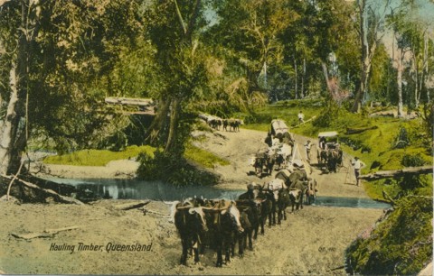
Most of the 'Queenslanders' were of timber construction, for Queensland's vast pastoral empires were accompanied by exploitable native timber, usually called 'scrub'. The scrub-like characteristic was often the ferns and vines, encircling furniture-quality trees that were grubbed out for pastures and maize or banana-growing. In the 1880s alienated land increased from 4½ to 10½ million acres, the area under crops doubled, and most of the newly alienated land underwent tree clearing. The vast Brigalow Belt of hardy Acacia scrubs from west of Mackay to the southern border resisted incursion until postwar mechanisation bowled them over.
1890s
The boom 1880s were followed by the 1890s Depression, the 1893 Brisbane flood and the 'federation drought'. Gold production was resistant to these misfortunes and northern sugar growing defied the shrinking agricultural sector. Cattle and sheep numbers, however, fell by about half during 1895-1905, and did not restore their losses until the early 1920s. The pastoral industry was also beset by labour strikes during the early 1890s, savagely crushed by employers and the parliament.
LABOUR
Organised labour identified parliament as a more fruitful target. It gained 20 seats in 1896 and held government for a few days in 1899 – the world's first Labour government. Better times for Labour lay ahead, in northern Queensland where ex-miners and workers took up sugar-cane farms, and new mineral finds brought in more miners. Red Ted Theodore and Big Bill McCormack, northern union organisers, would be Labor Premiers in the 1920s. Meantime, the Ryan Labor Government (1915-19) embraced State socialism, opening State butchers shops, pastoral stations, coal mines and coastal shipping. It challenged the CSR sugar monopoly, promoted soldier settlement and started the reservation of national parks.
RURALISM
Northern tropical forests, however, fell before closer-settlement farm selections in the 1920s. In the south, prickly-pear infestation covered 10 million hectares of land in 1920: the hardy cactus had easily colonised the drought-ravaged pastures after federation. By 1930 biological control had rid the country of prickly pear. Hand in hand with that achievement, timbered lands around Roma were also cleared. Agrarian rhetoric underpinned the land clearing, and the Labor Party strongly supported rural settlement. Within a couple of decades, Labor came to depend on rural constituencies to maintain its long incumbency, from 1932 until 1957.
Labor forged close alliances with the Australian Workers' Union, the Catholic Church and electoral mathematicians who devised rural-based gerrymanders to keep it in office. Premier Forgan Smith (1932-42) led a unified party after the Depression, and maintained an authoritarian hold on the Cabinet. His electoral seat was in Mackay. The party (and the AWU) was staunchly anti-Communist, holding on to Catholic support. (That, however, did not stop the Red North from electing the Communist Fred Paterson to Parliament in 1944.) Labor Premier Vince Gair, a Catholic (1952-57) was also in the authoritarian mould, and further perfected the electoral gerrymander. His hold on power was upset by the Labor Party split, which ushered in non-Labor rule for 32 years, with another authoritarian Premier for 14 of those years.
EDUCATION
Politicians were mostly can-do men, trained in the school of hard knocks. Formal education did not fare well, although Forgan Smith was an exception who supported the university. On the other hand, most high schools were in country towns. Brisbane State High opened in 1922, and no new high school was opened between 1924 and 1939. State secondary education languished. Primary schooling went to grade 8, when children reached Australia's lowest school-leaving age and were ready for labouring on family farms. Physical labour had priority over intellectual attainment. A potential leavening influence could have been libraries, usually in schools of arts, which numbered over 200 in 1911, along with another 56 at pastoral stations and sugar mills. The earliest, Brisbane (1849), had over 36,000 volumes, but others had as few as 100, and many of their books were popular novels. Most users of the institutes went in for recreational things. (Table II, section G of Statistics of Queensland 1911 reveals intriguing details of libraries and reading rooms.)
TRANSPORT
By the mid-1930s railway lines reached their maximum length, 10,569 km, including uneconomic rural spur lines and a linkage between the western lines out of Rockhampton and Townsville, connecting them through Winton. The next step was aviation. Queensland and Northern Territory Aerial Services QANTAS (1920) was headquartered in Winton, and began a regular service between Charleville (on the Western Line from Brisbane) and Cloncurry (Great Northern Line from Townsville) in 1922. By the mid-1930s many of the gaps between the railway lines had been filled by air services.
LOCAL GOVERNMENT
Ports and important inland towns had municipal councils by the 1870s. In 1879 much of rural Queensland was divided into local government divisions, each with an elected board. The job was done in a hurry, and the divisional boundaries copied those used for population censuses. As a result Fortitude Valley ('Booroodabin'), of three square miles, was a division, as was Bauhinia with 11,000 square miles. In 1902 the divisions were changed to shires, and in the next 12 years more local councils were created as closer-settlement areas demanded local representation. In 1916 there were 186 local-government councils, and amalgamations brought them down to 148 by 1930. Amalgamation had been Labor policy since the Ryan government, and in 1925 Brisbane was amalgamated with South Brisbane City, six towns and all or part of 11 shires to form Greater Brisbane Council. There were smaller amalgamations around Ipswich, Toowoomba and Maryborough in 1917-18, and some rural shires were amalgamated as Albert Shire (Gold Coast Hinterland) in 1949.
WATER AND RURAL BOOM
Coastal provincial politics and Queensland Labor were keen on rural development and water-storage projects. John Bradfield's scheme to turn the coastal rivers around to flow inland and make the desert blossom was popularised by Ion Idriess' The Great Boomerang (1943), but it was a pipe dream. It was nevertheless influential, building on the Labor Government's Dawson and Callide Valleys' irrigation projects. (Their main town, Theodore, was named after the Premier.) The sense of provincial and rural entitlement was not lessened by rumours about the military-retreat plan to a Brisbane Line in the event of Japanese invasion. After the war there was an impulse for peopling the 'empty north' by rural closer settlement. The Australian and British Governments embarked on land clearing for the Peak Downs farm settlement scheme (1949-53), and the Catholic Rural Movement had its supporter, Colin Clark, as financial adviser to the Queensland Treasury. The ambitious Tinaroo and Burdekin dams were completed in 1958 and 1987 for irrigated farming and hydro-electricity. Sugar and dairy production brought major export revenues. Wool production, a steady export earner, was more or less left to its own devices. After an early postwar drought, Queensland wool incomes skyrocketed:
| Year | Wool (kg) | Value ($) |
|---|---|---|
| 1945 | 78,584,000 | 21,728,000 |
| 1950 | 70,156,000 | 177,636,000 |
| 1951 | 62,944,000 | 94,380,000 |
| 1952 | 74,003,000 | 119,806,000 |
The annual value rose to 155 million dollars in 1956. Local shires built new halls, offices and swimming pools.
PROVINCIAL POWER AND EDUCATION
Provincial towns held 23% of Queensland's population and metropolitan Brisbane 36% in 1947. Manufacturing was strong in food processing and in metal fabrication and engineering. The metals sector was inherited from railway workshops, sugar-mill and mines machinery, and wartime munitions factories.
State secondary education remained in the doldrums: no Labor education minister had better than primary education, and only in 1952 was a capital-city high school (at Holland Park) opened, the first since Brisbane State High. Irresistible enrolment pressure was building up, however, and baby-boom enrolments were due in the early 1960s. Capital-city high school options were still patchy in the mid-1950s. Two sisters from Nundah chose between Domestic High and Brisbane State High, the latter involving train to Central Station and a tram to South Brisbane. Prepared for the teaching profession, a university degree was obtained by one year full-time and part-time completion at a subject a year. It was a small mercy that compulsory country service was done by a car ride across the Hornibrook Highway to 'rural' Clontarf High. Crash-course training was inevitable for staffing secondary teaching:
| State High Schools | |
|---|---|
| Year | Number |
| 1951 | 20 |
| 1959 | 46 |
| 1964 | 87 |
| 1973 | 116 |
Most of the building happened during the Premierships of Nicklin and Pizzey, after the defeat of Labor in 1957. Pizzey, educated at Bundaberg High and a former teacher, was Minister for Education from 1957 to 1968.
BAUXITE, BRIGALOW AND COAL
Bowen Basin's massive coal reserves were turned into an export bonanza, and Weipa bauxite was shovelled up with modern machinery.
| Mining Production (tonnes) | ||
|---|---|---|
| Year | Coal | Bauxite |
| 1965 | 4,221,000 | 604,000 |
| 1970 | 11,074,000 | 6,611,000 |
| 1975 | 24,182,000 | 8,831,000 |
| 1980 | 32,356,000 | 7,937,000 |
Gladstone was industrialised by alumina production and the Mackay harbours were linked by rail to the coal mines.
South of the Bowen Basin there was the Brigalow scrub. Postwar land clearing machinery conquered it at last, turning scrub cattle refuges into cereal paddocks. In the midst of the Brigalow scheme a former Burnett land-clearer assumed the premiership. Joh Bjelke-Petersen, school leaver at 14 and self-made businessman, was Premier from 1968 until 1982. An ardent advocate of Brigalow clearing, bauxite and coal, he (inadvertently) let a new industry flourish – corruption. An inquiry in 1987-89 brought several senior police to trial, and Bjelke-Petersen and his deputy, Russ Hinze, Minister for Local Government, Main Roads and Racing (fertile areas for lobbying interests) barely escaped conviction. The fallout changed Queensland forever. Intellectual attainment achieved respectability; and the 1988 World Expo was a confidence booster and turning point for Brisbane, no longer a backwater or a branch office.
POSTWAR SUNBELTS
The postwar improvements in aviation and car travel brought southern land entrepreneurs in touch with Queensland's tourist potential. From Melbourne there was Thomas Michael Burke, Alfred Grant and Stanley Korman. Burke, an estate agent, had opened a branch office in Brisbane in 1924 and pioneered holiday-house subdivisions at Noosa. His firm resumed development projects in the 1950s. Alfred Grant pioneered Florida-style canal estates (Miami Keys, Rio Vista) on the Gold Coast in 1957, and in the early 1960s turned his attention north to Kawana Waters. Both Burke and Grant built public bridges and/or roads in return for land grants. The most flamboyant was Stanley Korman, who put Surfers Paradise on the map with his Chevron Hotel (1958) and further canal estates. Bruce Small, the Melbourne proprietor of Malvern Star bicycles, became Mayor of Gold Coast Council and leading advocate of Gold Coast Inc.
In 1933 the Moreton District (Maroochy, south to border; Brisbane to the edge of Toowoomba) had 45% of Queensland's population. Sunbelt urbanisation and natural growth in Brisbane brought the proportion to 54% in 1961 and 60% in 1981. Sugar production in the Moreton district fell away, but in north Queensland it bounded ahead (see Sugar Regions entry). Dairying in the Moreton district stayed buoyant, having a growing population to buy its products. In the rest of Queensland dairying declined, except on the Atherton Tableland. Elsewhere new primary-produce sectors emerged.
COASTAL CITIES
It was not only the Moreton District coastline which grew during the 1970s-90s. Most of the coastal port towns attracted new residents, some from country towns and some from interstate, often sun-seeking retirees. A few, such as Gladstone, Mackay and Townsville, gained population from industrial growth: Gladstone, alumina, coal and port growth; Mackay, coal; Townsville, north Queensland's freight, university and business centre. Other cities grew from tourism and retiree settlement (Cairns, Hervey Bay, Yeppoon). Recent population censuses were:
| Population | ||||
|---|---|---|---|---|
| Place | 1961 | 1981 | 1991 | 2006 |
| Bundaberg | 31,000 | 47,000 | 57,000 | 72,000 |
| Cairns | 40,000 | 66,000 | 93,000 | 127,000 |
| Gladstone | 7,000 | 24,000 | 23,000 | 46,000 |
| Maryborough, Hervey Bay | 28,000 | 35,000 | 51,000 | 78,000 |
| Rockhampton | 44,000 | 54,000 | 60,000 | 59,000 |
| Townsville | 54,000 | 100,000 | 125,000 | 155,000 |
| Whitsunday Shire | 5000 | 12,000 | 15,000 | 17,000 |
| Yeppoon | 3000 | 6000 | 8000 | 13,000 |
Notes: 'Places' are roughly equivalent to the amalgamated regional councils (2008); eg 'Townsville' is the former cities of Townsville and Thuringowa. Rockhampton's less spectacular growth is partly because people have settled in its coastal watering place, Yeppoon. Whitsunday Shire (2006 boundaries) includes the Airlie Beach tourist spots.
EMPLOYMENT CHANGES
West of the dividing range there has been population loss, particularly in small towns as their services have been soaked up by regional towns such as Longreach. Pastoral employment has fallen. The postwar employment changes in Queensland are shown in the following table.
| Employment by Industry (% of Total Employment) | ||
|---|---|---|
| Industry | 1954 | 2001 |
| Agriculture, Forestry, Fishing | 20.4 | 4.9 |
| Mining, Quarrying | 1.8 | 1.3 |
| Manufacturing | 20.6 | 10.7 |
| Electricity, Gas, Water | 1..9 | 0.8 |
| Building, Construction | 9.4 | 7.1 |
| Transport, Storage | 7.5 | 5.0 |
| Communication | 2.2 | 1.5 |
| Finance, Property | 2.4 | 12.7 |
| Wholesale, Retail | 15.1 | 20.4 |
| Government, Law, Health, Education | 12.4 | 22.0 |
| Amusements, Hotels, Cafes, Personal Services | 1.0 | 5.6 |
Notes:
- Industry categories changed between 1954 and 2001, so percentages are indicative rather than strictly accurate. In 2001 the figure of 5.6% was for accommodation, cafes and restaurants; cinema, theme-parks etc employment counted elsewhere.
- Employment in retail overstated because part-time employees each counted as a whole employee. Nevertheless, the increase is striking, as self-service came after 1954.
- The figures for finance and property speak volumes for the real estate industry.
Despite mechanisation and open-cut methods in mining, employment in mining and quarrying was buoyant. Coal was a big part of that:
| Queensland Coal Production (million tonnes) | |
|---|---|
| 1965 | 4.2 |
| 1975-76 | 24.2 |
| 1985-86 | 64.0 |
| 1995-96 | 93.8 |
| 2005-06 | 226.7 |
About 80% of coal mined is saleable, and about 85% of the saleable coal is exported.
POLITICS
32 years of National Party/Liberal government ended in 1989, and since then there have been Labor governments except during 1996-98 and from 2012. Queensland had seemed to shrug off accusations of rural backwardness or being a Cinderella state, but there were reminders of some differences. In 1989-90 the south-east corner annoyingly brought in daylight saving. People in the west and the tropics hated it: the best sleep in summer was in the early morning. A referendum ended the experiment. In the mid-1990s regional Queensland was suffering job losses, local bank closures and other economically-rationalist adversities. Around Ipswich an independent local, Pauline Hanson, was elected to federal parliament. Her policies were highly critical of 'over-advantaged' Aborigines and migrants, and her One Nation Party (1979) harkened back to White Australia and the former rural and manufacturing backbone of the national economy. One Nation won over 20% of the vote in the Queensland election in 1998, causing more damage to the Nationals than Labor. Labor barely scraped in; but the victory started the uninterrupted premierships of Peter Beattie (1998-2007) and Anna Bligh (2007-12). In 2012 the Liberal National Party swept to victory at the State election with former Lord Mayor of Brisbane, Campbell Newman, installed as premier.
Daylight saving and One Nation reminded Australia that Queensland could be 'different'. A compelling rejoinder to old Queensland attitudes came in 2007 when two Nambour High School old boys became Commonwealth Prime Minister and Treasurer. And in 2008 Prime Minister Rudd nominated Moreton Bay College old girl, Quentin Bryce, as Governor-General. Queenslanders might then have wondered if Australia was being run by Queenslanders. When Julia Gillard replaced Rudd as Prime Minister in 2010, Queenslanders punished the Labor Party at the federal election with the loss of seven seats in the State.
Queensland's census populations have been:
| Census Date | Population | Census Date | Population |
|---|---|---|---|
| 1861 | 34,000 | 1935 | 971,000 |
| 1865 | 87,000 | 1940 | 1,031,000 |
| 1870 | 115,000 | 1945 | 1,085,000 |
| 1875 | 169,000 | 1950 | 1,205,000 |
| 1880 | 211,000 | 1955 | 1,359,000 |
| 1885 | 317,000 | 1960 | 1,502,000 |
| 1890 | 392,000 | 1965 | 1,659,000 |
| 1895 | 443,000 | 1970 | 1,813,000 |
| 1900 | 494,000 | 1975 | 2,072,000 |
| 1905 | 531,000 | 1980 | 2,302,000 |
| 1910 | 599,000 | 1985 | 2,579,000 |
| 1915 | 685,000 | 1990 | 2,929,000 |
| 1920 | 751,000 | 1995 | 3,302,000 |
| 1925 | 845,000 | 2001 | 3,586,000 |
| 1930 | 917,000 | 2006 | 3,905,000 |
| 2011 | 4,332,739 |
G.C. Bolton, A thousand miles away: a history of north Queensland to 1920, Brisbane, Jacaranda Press, 1963
Raphael Cilento, Triumph in the tropics: an historical sketch of Queensland, Fortitude Valley, Smith and Paterson Pty Ltd, 1959
Raymond Evans, A history of Queensland, Melbourne, Cambridge University Press, 2007
Ross Fitzgerald, From the Dreaming to 1915 (and) From 1915 to the early 1980s: a history of Queensland (2 vols), St Lucia, UQP, 1982, 1984
Ross Fitzgerald, Lyndon Megarrity and David Symons, Made in Queensland: a new history, St Lucia, UQP, 2009
Rupert Goodman, Secondary education in Queensland, 1860-1960, Canberra, ANU Press, 1968
W. Ross Johnston, The call of the land: a history of Queensland to the present day, Milton, Jacaranda Press, 1982
John Kerr, Triumph of narrow gauge: a history of Queensland Railways, Moorooka, Boolarong Press, 1990, 1998
J.M. Powell, Plains of promise, rivers of destiny: water management and the development of Queensland 1824-1990, Brisbane, Boolarong, 1991
Henry Reynolds and Dawn May, 'Queensland' in Ann McGrath ed, Contested ground: Australian Aborigines under the British Crown, St Leonards, NSW, Allen and Unwin, 1995
L.E. Skinner, 'Pastoral frontiers of Queensland' in Settlement of the colony of Queensland, Brisbane, Library Board of Queensland, 1978
Socialism at work, Brisbane, Government Printer, 1918
Drought, dust and deluge: a century of climate extremes in Australia, Canberra, Bureau of Meteorology, 2004
Climate of Queensland, Canberra, Bureau of Meteorology, 1992
Peter Saenger, Queensland's western afterthought: 150 years of ups and downs, East Lismore, Tankard Books, 2012
Bowen Basin, Brigalow Belt, Cape York Peninsula, Channel Country, Darling Downs, Dry Tropics, Great Barrier Reef, Gulf Country, Herberton Minerals Area, Hodgkinson Minerals Area, Mary Valley, Moreton Bay, Moreton District, Palmer River, Sugar Regions, Sunshine Coast, Torres Shire, Wet Tropics, and Wide Bay-Burnett entries