Russell, Macleay and the smaller Karragarra and Lamb Islands lie in Moreton Bay, with Redland Bay and the mouth of the Logan River on their west and North Stradbroke Island on their east.
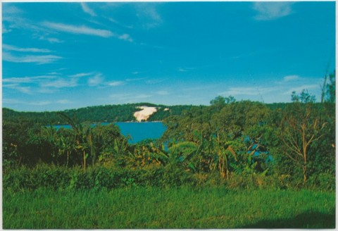
The geological origin of these islands is shared with the Redland Peninsula: all have the characteristic fertile red soil which enabled the peninsula to be the market garden for Brisbane. Overlain on parts of the island's red soil are more recent sediments, chiefly sand and mud from the mainland river deltas.
Russell Island was named after the British Secretary of State for Colonies, Lord John Russell. In 1871-72 farm lots were sold on the island, the quality of the soil being a strong attraction. Sugar cane and pineapples were grown, and cattle and pigs were raised. A sawmill was kept supplied from natural stands of trees on the island. In 1916 a primary school was opened drawing children from the four islands. Fruit and vegetables were grown for the Brisbane market in the 1920s-30s.
The middle of Russell Island contains Turtle Swamp, mainly heath land, and the southern part has sandy soil with a trace of wallum country. Subject to tidal inundation in places, much of it was speculatively subdivided in the 1970s, culminating in a criminal trial for conspiracy in 1981-83.
Russell Island has local shops, a primary school, a hall, a church and a bowling club.
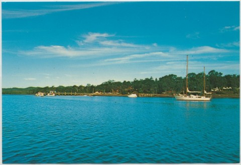
Macleay Island, the northern-most of the group, was named after Alexander Macleay, the New South Wales Colonial Secretary 1825-37. Its fertile southern end was settled first in the early 1870s. The jetty is at that end, near the ruins of an early salt works and other industries. The ruins are listed on the Queensland heritage register. The northern half of the island is sandy with elevated swamps. In common with Russell Island, this part was subdivided in the 1970s. Macleay Island has local shops, a hall, a primary school (1986) and golf and bowling clubs.
Lamb and Karragarra Islands lie between the two larger islands. Lamb has a bowling club and a hall.
All islands are accessed by boat from Redland Bay. Various high-flown plans for bridges have not eventuated.
Census populations of Russell-Macleay Islands have been:
| Census Date | Population | ||||
|---|---|---|---|---|---|
| Russell Island | Russell-Macleay | Macleay Island | Karragarra Island | Lamb Island | |
| 1911 | 21 | ||||
| 1921 | 108 | ||||
| 1954 | 78 | ||||
| 1961 | 158 | ||||
| 1976 | 343 | ||||
| 1986 | 1087 | ||||
| 1991 | 2001 | ||||
| 2001 | 3783 | ||||
| 2006 | 1779 | 1958 | 125 | 373 | |
| 2011 | 2473 | 2572 | 160 | 427 | |
Brisbane: Moreton Bay matters, Kelvin Grove, Brisbane History Group, 2002
Helen Horton, Islands of Moreton Bay, Brisbane: Boolarong Publications, 1983