Sarina Shire, an area of 1444 sq km immediately south of Mackay, was amalgamated with Mirani Shire and Mackay City in 2008 to form Mackay Regional Council (see separate entry). It extended from the Connor Range to the Pacific Ocean, and included Prudhoe, Knight and Temple Islands.
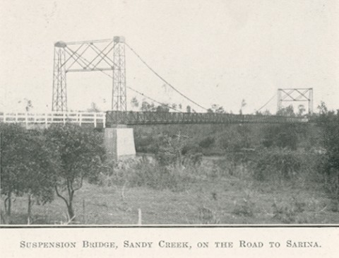
The shire was formed in 1912 by severance from Pioneer Shire and was named after the town of Sarina (see separate entry) built around the Plane Creek central sugar mill. Nearly half the shire's population was in the town, and other small settlements were Alligator Creek, Grasstree and Koumala. The ratio of town to shire population stayed much the same until the 1970s, when coastal settlements such as Grasstree Beach, Half Tide Beach and Hay Point were developed.
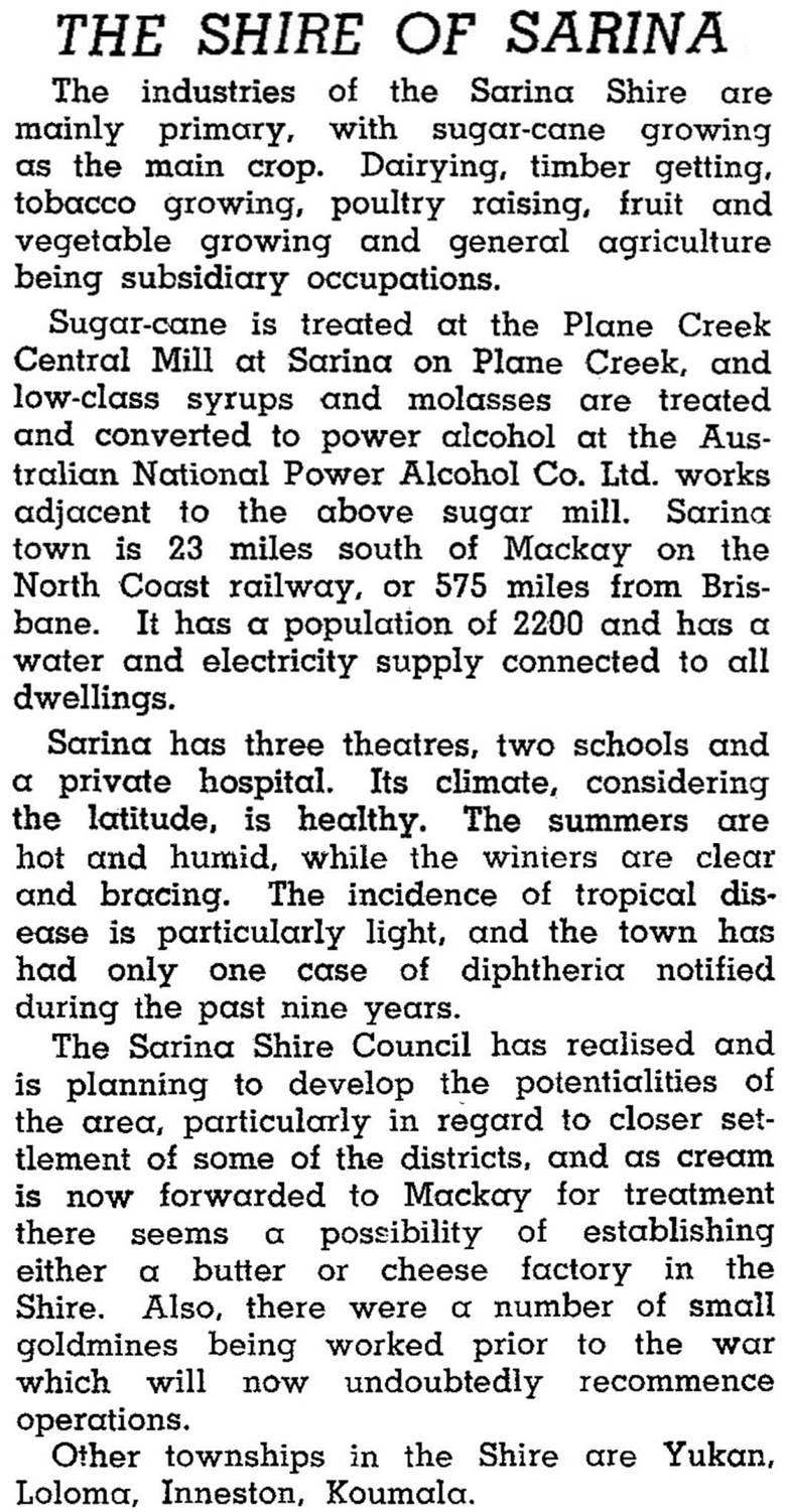
The Plane Creek sugar mill was built after the one at Homebush (west of Sarina), but it became the sole mill in the district when the Homebush mill closed in 1921. The completion of a railway link from Mackay to Broadsound, via Sarina, also occurred in 1921. An alcohol distillery next to the Plane Creek mill was opened in 1927, to exploit the previously discarded molasses, and this strengthened the sugar economy around Sarina. In 1946 Sarina Shire was described in the Australian Blue Book:
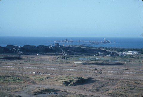
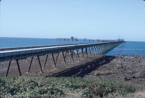
The shire continued as a rural economy until the 1970s when beachfront settlements were developed and the massive Hay Point coal-export terminal was opened in 1971. The neighbouring Dalrymple Bay terminal was opened in 1983, and both are serviced by a separate railway line from Goonyella and Riverside open cut mines south west of Mackay.
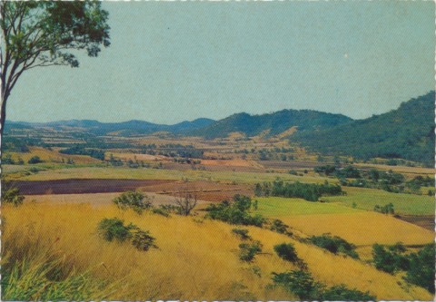
Although sugar stands out as an important sector, the agricultural economy of Sarina Shire is varied. In 1992 there were 28,600 beef cattle, 2040 dairy cattle and 14,000 ha of field crops other than sugar and fodder. Sugar was grown on 10,350 ha, producing 677,700 tonnes of cane. The leading employment sectors in the shire were Retail and Wholesale (17% of total employment), Agriculture (13%), Transport and Storage (12%) and Manufacturing (12%) Agricultural employment has diversified into fruit growing and aquaculture (including a prawn hatchery at Grasstree Beach). During the 1990s-2000s there was considerable population growth in coastal townships, notably Hay Point and Sarina Beach. Inland towns such as Koumala, Alligator Creek and Sarina also had population increases.
The shire also included Mount Blarney and Mount Hector environmental parks and Cape Palmerston.
Sarina Shire's census populations were:
| Census Date | Population |
|---|---|
| 1921 | 1635 |
| 1933 | 3121 |
| 1961 | 3886 |
| 1971 | 5422 |
| 1981 | 6922 |
| 1991 | 8081 |
| 2001 | 9456 |
| 2006 | 10,360 |
John Kerr, Pioneer pageant: a history of Pioneer Shire, Mackay, Pioneer Shire Council, 1980
Patricia Phillips, Sarina Shire in retrospect, Sarina Bi-centenary Committee, 1988
Alligator Creek (near Mackay), Grasstree Beach, Half Tide Beach, Hay Point, Koumala and Sarina entries