West End, an increasingly residential inner suburb, is 3 km south-west of central Brisbane, across the Brisbane River. The name is presumed to have been inspired by West End, London.
Throughout the 1850s and 1860s West End was a district of farm families, and in 1864 the Boundary Hotel in Boundary Street was first licensed. More significant settlement occurred in the next decade with the opening of a post office (1874), a school in Vulture Street (1875) and a Congregational church in Brighton Road (1878). The ferry service across to Toowong began in 1876.
Access to South Brisbane and West End was facilitated by the opening of the first Victoria Bridge (1860s), but not until 1872 was there a satisfactory permanent structure. Most south-side settlement kept to the South Brisbane riverbank and wharves, and not until the 1880s did a row of shops appear in Boundary Street. Industry was located along Montague Road, a notable early example being the South Brisbane Gas Works, next to Davies Park, c1885. West End sawmills and steam joinery was another early example.
In 1887 a horsedrawn tram service from Melbourne Street into Boundary Street began operation, and in 1889 another ferry service, from Hill End to St Lucia began. The Boundary Street school of arts (1889-1968) opened near the farm terminus at Vulture Street, beginning a civic precinct which later included the Methodist Church, the Gospel Hall, the Kurilpa Hall and the Lyric picture theatre (1909). A crèche (1918) and kindergarten were opened a short way south.
The floods in 1893 covered all the shoreline around West End, sweeping away several houses at Hill End. They left bare the land which was purchased in 1916 by the South Brisbane Council to create Orleigh Park. By that time there was a comprehensive electric tram service in West End, along Vulture and Hargrave Streets (1898), putting most residents and workers within easy walking distance of a tram stop. The service was extended to the St Lucia ferry service at the end of Hoogley Street in 1929.
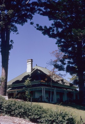
From the 1890s until the 1930s there was steady industrial development in West End. Thomas Dixon's tannery between Montague Road and the river, along Ferry Road, was a landmark, along with the boot and shoe factory (1908) on the other side of Montague Road. A later, and more benign, landmark was Tristram's softdrink factory in Boundary Street (1928). Designed in the popular Spanish mission style of architecture, it was conveniently close to the West End shopping strip to be converted to a supermarket with drive-in shops. In a different architectural style, Georgian Revival, the Brisbane City Council built the heritage-listed Kurilpa library in Boundary Road in 1929. It is Queensland's first purpose-built local library, and is surmounted by a war memorial clock tower.
There were at least two proposals for a bridge across the river to St Lucia (1885, 1940). Both occurred in the lead-up to a depression or a world war and did not materialise. West End was spared the burden of a through motorway and remained an industrial and residential suburb, albeit with low house prices. The residential property market suited overseas newcomers, and a substantial Greek community emerged as early as 1950 when it acquired the Methodist Gospel Hall for the Greek Evangelical Church. There was ample manufacturing employment in gas, glass and pipe-making, along with other industries in Montague Road and Boundary Street. The Greek Orthodox Church in South Brisbane had over 1350 adherents in 1983.
During the late 1980s the Greek community began to be displaced by Vietnamese immigrants, and the general character of West End altered as industry withdrew to outer metropolitan Brisbane. The shoreline from Hill End to the Merivale Bridge was raised with rockfill, covering the river baths (1921) at Davies Park, and Riverside Drive was constructed (1979).
The West End shopping strip in Boundary Street has developed an active café culture whilst retaining an adequate range of everyday retailing.
Residential property prices have risen, reflecting the popularity of inner suburban locations with active local shopping and dining facilities.
West End's Aboriginal name was Kurilpa, recorded as a locality until the closure of the Kurilpa post office at the corner of Hardgrave Road and Dornoch Terrace. A short way west is Hill End, the downward slope of the ridge along Dornoch Terrace. To the east, in Dornoch Terrace, there is the Aboriginal and Islander Independent Community School (1986) next to the St Francis of Assisi Catholic church.
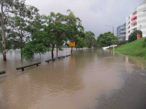
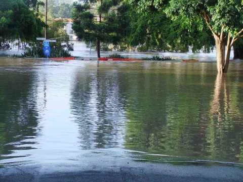
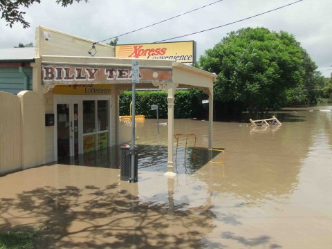
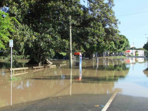
FLOODS 2011
In January 2011 waters from the Brisbane River invaded West End as far as Montague Road. Orleigh Park was flooded, but so too were some adjoining dwellings. Further east, in the vicinity of the ferry terminal, floodwaters ran as far in as Gray Road. The terminal was badly damaged by the raging river.
| Census Date | Population |
|---|---|
| 1976 | 6278 |
| 1991 | 5965 |
| 2001 | 5741 |
| 2006 | 6206 |
| 2011 | 8061 |