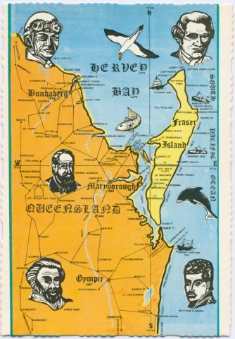
Wide Bay-Burnett is a region with Maryborough approximately mid-point on its eastern coastal boundary. The other boundaries are defined by mountain ranges: anti-clockwise from the north, Dawes Range (near Miriam Vale), the Dividing Range (Monto to Kingaroy districts) and the Cooyar and Brisbane Ranges ending near the Noosa district. Until 2008 the region contained 23 local government authorities, covering 52,140 sq km and including the cities of Bundaberg, Hervey Bay, Maryborough and Gympie. Noosa, once part of Wide Bay-Burnett, was changed by the state government to the Moreton and Brisbane region. Municipal amalgamations in 2008 reduced the number of councils to five, plus Cherbourg Aboriginal Shire Council and the southern part of Gladstone Regional Council.
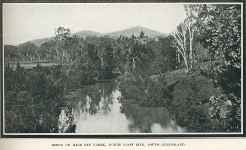
The encircling ranges define watersheds: the Mary and its tributaries, running through Gympie and Maryborough into Wide Bay; the Burrum River, to Burrum Heads; the Burnett, draining the north-west and south-west sectors, and flowing in an arc through Gayndah and Bundaberg to Burnett Heads; further north, the Kolan River and Baffle Creek drain small catchments. The Burnett system drains about 60% of the Wide Bay-Burnett region, and the Mary system about 18%.
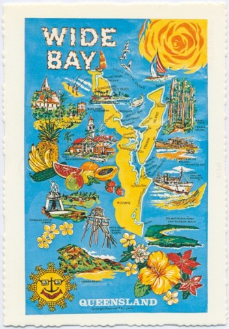
Wide Bay was named by James Cook on 18 May 1770 when he passed Double Island Point (now the tip of the Great Sandy National Park) and noticed the coast trending north-west and forming 'a large open bay'. In reality the bay is a coastal indentation, smaller than Hervey Bay to the north which was also named by Cook. Wide Bay assumed significance as the access way for shipping to the Great Sandy Strait, which separates Fraser Island from the mainland, and from there to the region's first port, Maryborough (1847). The bay itself is but a small part of the larger region that bears its name.
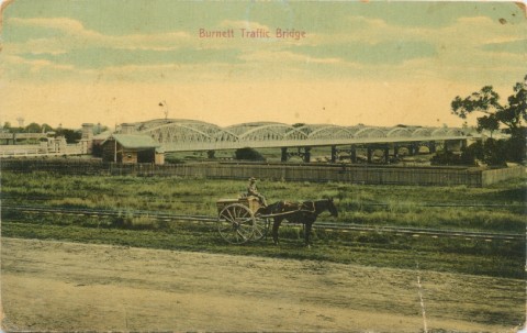
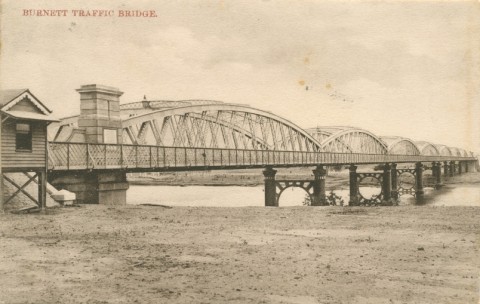
The Burnett River was named after John Burnett (1815-54) who followed it inland to its tidal reaches in 1847. Finding the river unsuitable for a port, Burnett then surveyed the mouth of the Mary River which enters Wide Bay and his report on that river gave rise to the choice of Maryborough as Wide Bay's maritime outlet.
THE PORT AND RAILWAYS
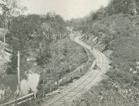
For 20 years Maryborough was the sole significant town in the Wide Bay district. In 1866 some selectors went in search of timber near the Burnett River and selected half a square mile for planting coffee and sugar. Cane growing proved to be a successful crop, leading to intense farming and settlement around Bundaberg. In 1867 gold was discovered at Gympie. Communication with the goldfield township was difficult either from Brisbane or Maryborough, and the first railway communication (1881) was to Maryborough. Until the line to Brisbane was completed ten years later, the Wide Bay district's railway system functioned solely for that district. Maryborough was joined by rail to Bundaberg in 1888.
Even before completion of the Brisbane link lines were opened from Gympie to Kilkivan (1886), from Isis (between Maryborough and Bundaberg) to Childers (1887) and from Maryborough to Biggenden (1891). An inland line from Bundaberg to Mount Perry's gold and copper mines was opened in 1884.
Between 1880 and 1920 Maryborough was Queensland's second most important industrial town. Its river port - often troubled by shallows - and the Urangan pier exported livestock and sugar. Its foundries and engineering works made and repaired mining and sugar-mill machinery. Bundaberg developed a considerable sugar hinterland, centred on the Burnett Valley and Childers. The Fairymead Mill (1885) north of Bundaberg functioned as both a mill and a village community.
Railway lines pushed inland: from Kilkivan to Goomeri (1902), thence to Kingaroy and Nanango (1904, 1911); westwards from the Maryborough district to Mundubbera (1914), and northwards to Monto (1924). Pastoral stations were resumed for closer-settlement, and local dairy factories were opened. The Wondai, Murgon and Kingaroy districts were intensively settled for grazing and cropping. Where there had been one shire for these districts, three were created between 1909 and 1914. Mundubbera and Monto Shires were created in 1915 and 1932.
The mining districts of Gympie and Mount Perry experienced population decreases as mining declined in the early 1900s. Most pastoral shires maintained steady populations until the 1950s, but declined in numbers in the next 50 years. Dairying losses were particularly severe. The sugar shires around Bundaberg, Gooburrum, Isis, Kolan and Woongarra had moderate population increases, except Kolan. During recent years they benefited from the urban spillover from Bundaberg. Agriculture was sustained by the Fred Haigh dam (1975) on the Kolan River, named after the Queensland Water Supply Commissioner. Other water storages in Wide Bay-Burnett are Boondooma (1983) west of Murgon and Bjelke-Petersen (1988) east of Wondai.
POPULATION GROWTH AND TOURISM
From 1900 to 1950 the populations of Bundaberg and Maryborough were roughly equal. Bundaberg's grew at about twice the rate of Maryborough's during the next 50 years, but separate urban areas (Pialba, Urangan etc) around Hervey Bay bolstered the Maryborough district. Shires around each city were reconfigured to account for urban growth. Other coastal towns include Bargara, Burnett Heads and Tin Can Bay. Across from Tin Can Bay is Fraser Island, a major tourist destination.
Municipalities absorbed by others were Burrum, Gooburrum, Widgee and Woongarra Shires. All have their own entries.
| Census Date | Population |
|---|---|
| 1921 | 84,750 |
| 1933 | 104,192 |
| 1954 | 118,331 |
| 1971 | 126,647 |
| 1976 | 141,670 |
| 1986 | 168,953 |
| 1991 | 195,259 |
| 1996 | 226,580 |
| 2001 | 236,580 |
| 2006 | 263,209 |
| 2011 | 273,267 |
Cherbourg entry