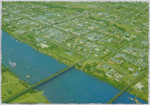
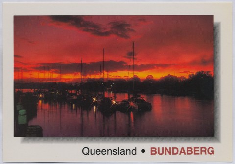
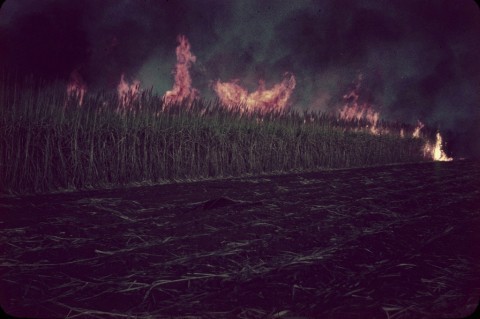
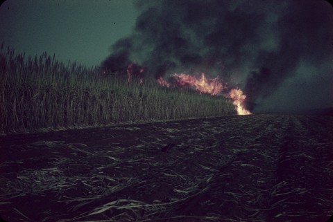
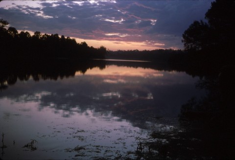
Bundaberg, a city, is 220 km north of Brisbane, and 15 km upstream on the Burnett River which enters the northern end of Hervey Bay. Situated about midway between Maryborough and Gladstone, Bundaberg's settlement as a town postdated those places by 20 or more years. Developing rapidly from the 1880s on the basis of sugar and associated industries, especially rum, Bundaberg is still surrounded by sugar cane farms and its sugar mills remain dominant features in the landscape.
The Burnett River was charted by the colonial surveyor, John Charles Burnett, after whom it was named, in 1847. Pastoral occupation of the lower reaches of the Burnett began in the late 1850s. A byproduct of the pastoral industry was tallow, which was stored in wooden barrels. Two itinerant pastoral workers, John and Gavin Stewart, secured a contract to supply timber for tallow casks at a boiling-down works at Baffle Creek, 60 km north-west of the future town. Learning of ample supplies of timber on the Burnett, and of the possibility of transporting it by the river to Baffle Creek, they secured a selection in 1866 on the site of the present day Bundaberg North. Most of the district was forested, incorrectly termed 'scrub', on mainly volcanic soil: the Woongarra, Barolin and Gooburrum scrubs were later cleared for the Bundaberg sugaropolis.
A sawmill and a small European settlement were formed on the north bank of the river, and in 1868 the district surveyor, John Thompson, was instructed to mark out a town reserve on the south bank. It was named Bundaberg, derived probably from an Aboriginal word describing the local tribe or place, and from the Teutonic term 'burgh', signifying a town.
THE COMING OF SUGAR
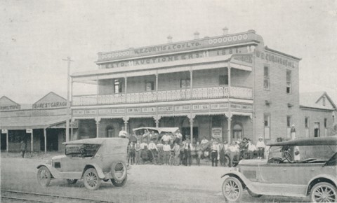
Bundaberg's emerging farm lands concentrated on maize until the mid-1870s, when prices fell and sugar was vigorously taken up. The Stewarts had constructed a wharf on the north bank, which was used for the transport of copper brought down from the Mount Perry mines (1871), 100 km to the west. This activity brought Bundaberg out from under the influence of the more established town of Maryborough. Bundaberg's second newspaper was called the Bundaberg and Mount Perry Mail (1876), suggesting the close relationship between town and mine. State and Catholic schools were opened at North and South Bundaberg between 1874 and 1876. With a population approaching 1000, Bundaberg was described in 1876 in the Australian Handbook:

In 1881 the Bundaberg district produced 3% of Queensland's sugar. Two years later it produced 20%. During 1882-83 the district's production increased nearly seven-fold. There were many small juice mills, but three long living enterprises emerged: the Mon Repos factory (later Qunaba) east of Bundaberg, based on the fertile Woongarra scrub land; Fairymead, 10 km north of Bundaberg beside the Burnett River; and the Millaquin refinery in East Bundaberg, where juice was later piped for processing. Bundaberg reached a stage of maturity when the railway to Mount Perry was started, the town was incorporated as a municipality and a hospital was opened (all 1881).
The growth of the sugar industry owed much to the recruitment of indentured labourers South Sea Islanders (then known as Kanakas), mainly Solomon Islanders, who worked the big plantations. There was a 'Kanaka' ward at the hospital, but the death rate was appalling, perhaps also because the plantation hospitals were sub-standard. Not all deaths resulted from illness: others were due to fights and mill accidents. Of the 2548 Islanders registered in the Bundaberg district in 1896, 102 died. Repatriation of many of the workers under the Pacific Island Labourers' Act 1901 led to the breakup of plantations and their replacement by small farmers.
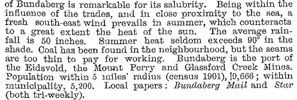
The sugar and mining industries, and railway construction, encouraged the formation of local foundries and engineering works (Mount Perry line 1881-84, and connection along the north coast line 1888-91). The rum distillery next to the Millaquin refinery started in 1888. Educational opportunity was enlarged, with a rebuilt school of arts (1889) and the Bundaberg Technical School (1898). Bundaberg's population exceeded 5000 people in 1901, and in 1903 it was described in the Australian handbook:
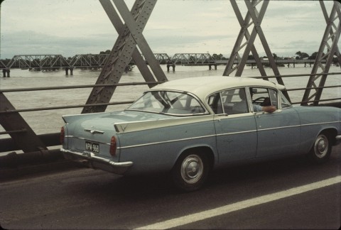
A notable disadvantage of the river port was the need for dredging, a problem that continued for over 50 years until the deep water, New Bundaberg port was opened near Burnett Heads in 1962.
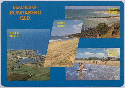
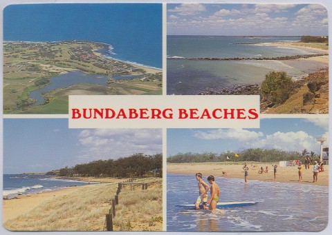
Bundaberg residents enjoyed boating and rowing on the river, and a few ventured to the infant coastal resorts at Burnett Heads and Bargara, whose origins went back to speculative subdivisions in the 1880s. In 1912 the railway line for the Millaquin refinery was extended to Bargara, ushering in popular annual railway picnics to the seaside. On the other side of Bundaberg, a branch line was opened south-west to Wallaville in 1920.
MONCRIEFF AND HINKLER
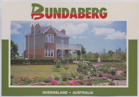
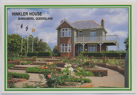
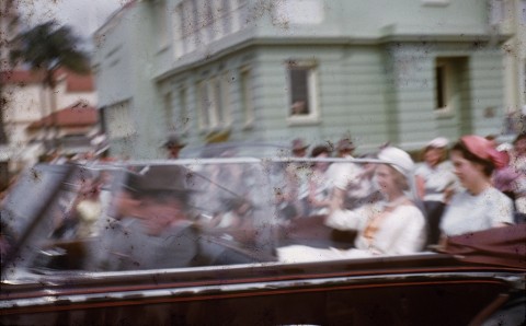
In 1892 Bundaberg's two most famous citizens were born, Gladys Moncrieff and Bert Hinkler. Twenty years later Moncrieff, after auditioning before Nellie Melba, secured a three year contact with J.C. Williamson Theatres while Hinkler successfully flew his glider from a sand dune near Bargara. Moncrieff went on to a world-wide singing career, retiring to the Gold Coast in 1968. Hinkler made numerous world survey flights and won aviation trophies, before fatally crashing in the Italian alps in 1933. They are commemorated by the Moncrieff Theatre in Bourbong Street and the Hinkler Museum in the Botanic Gardens, Bundaberg North. A replica of Hinkler's glider hangs in the Hinkler tourist centre.
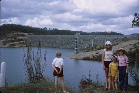
In 1897 the Bundaberg cooperative dairy company was formed, signifying a degree of agricultural diversification. Nevertheless, sugar remained dominant. It was hampered by intermittent disease and occasional low crops during drought years. Disease-resistant stock was found and irrigation was tried. A weir was built on the Burnett in 1937 and aquifers were tapped east of the town. Large-scale storage and irrigation systems came in the 1970s, in time for diversification into vegetable growing, especially tomatoes. Southern markets began to benefit from year-round supplies of previously seasonal summer vegetables. A fruit and vegetable research station was opened in 1986 at Kalkie, 5 km east of Bundaberg.
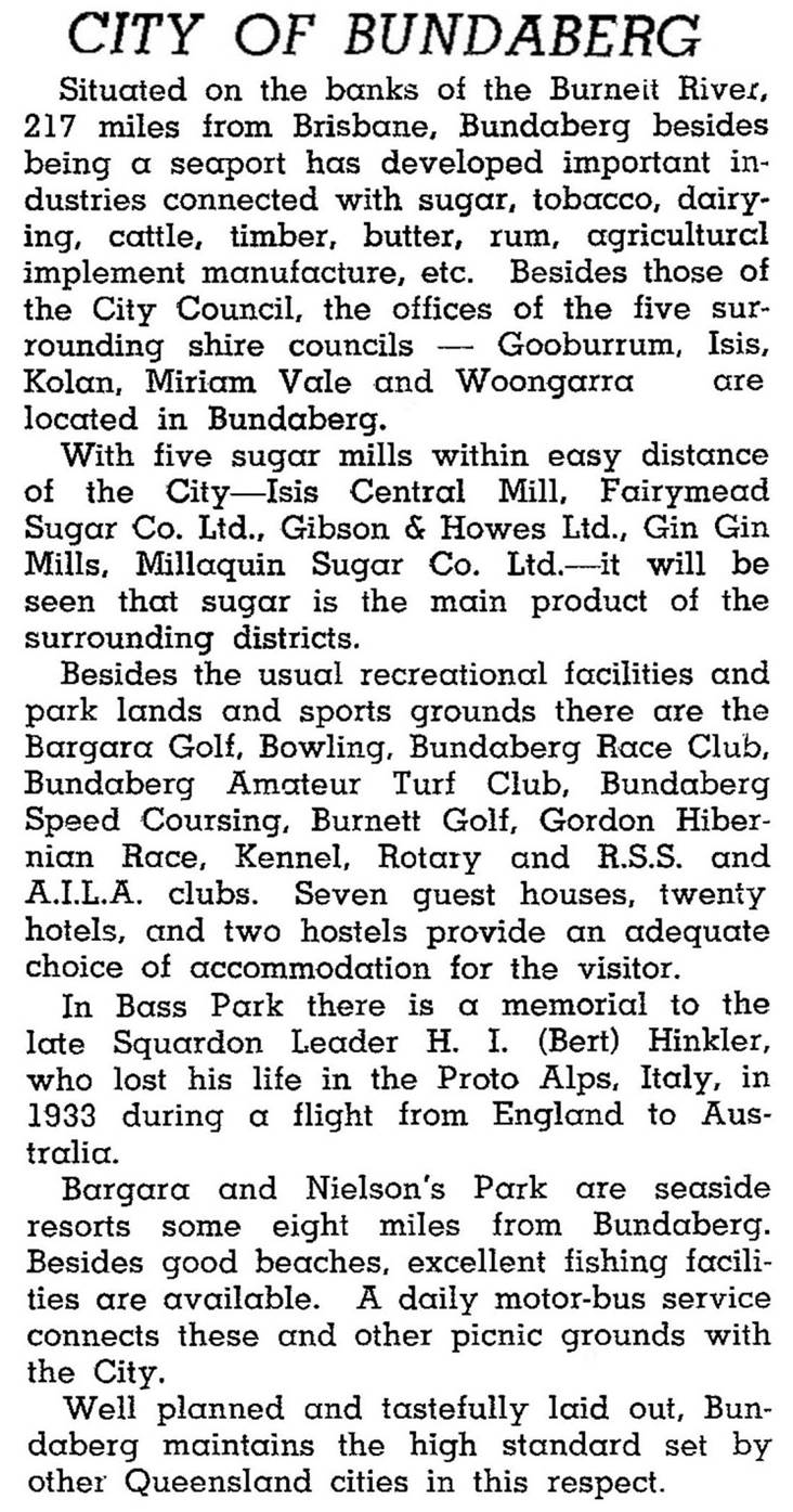
Bundaberg was described in the 1946 Australian Blue Book:
CITY SIZE AND POPULATION GROWTH
Bundaberg's commercial and civic areas were substantially rebuilt during the 1950s-60s. The work was supported by a local parliamentarian, E. J. Walsh, who became State Treasurer in the ALP government, and by ambitious mayors. A second high school was opened in Kepnock in 1964 and a city civic centre was built in 1962. Nearly all of Bundaberg was sewered by 1967.
When the Bundaberg municipality was created in 1881 it had an area of 4.1 sq km. In 1913 it was gazetted as a city. In 2001 the city had an area of 96 sq km. While this included a substantial rural hinterland, it understated the regional urban population, with the coast towns of Burnett Heads, Bargara and Elliott Heads having a combined total of 9000 people. Consequently Bundaberg's general hospital had a catchment population of over 60,000. It has six secondary colleges, Catholic, Lutheran and Seventh Day Adventist primary schools, nine State primary schools, TAFE and a Central Queensland University campus.
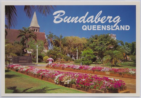
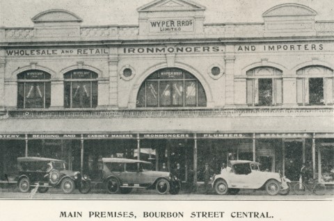
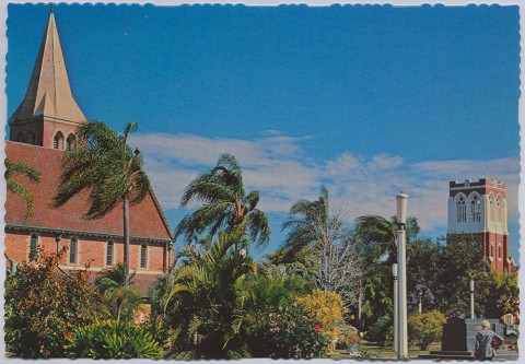
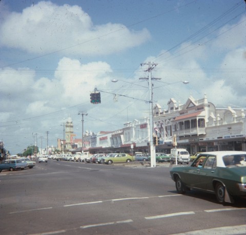
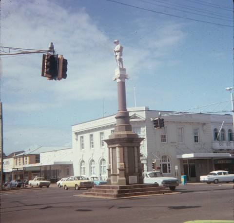
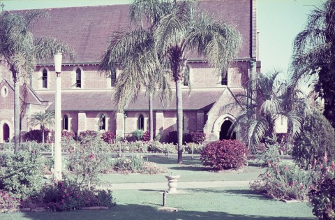
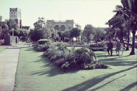
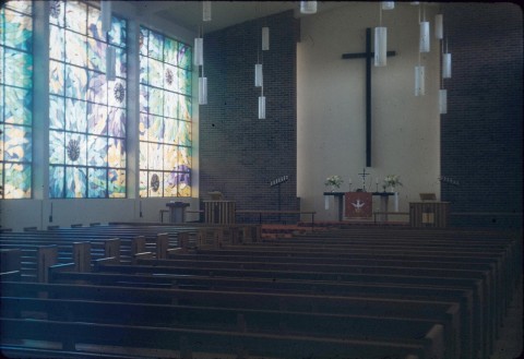
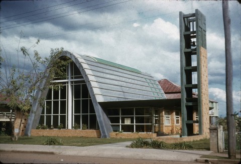
Bundaberg has numerous suburbs (see separate entry). The city centre's commercial heart is in Bourbong Street, adjoined by the civic precinct with several churches, State and Catholic primary schools and the civic centre. The customs house (1902) is in Quay Street, one block north, and is the arts centre. The Bundaberg high (1912) and technical schools are further south, together with the Hinkler drive-in shopping centre. The Sugarland Shoppingtown is in the western suburb of Avoca.
In 2008 Bundaberg City was amalgamated with Burnett, Kolan and Isis shires to form Bundaberg Regional Council (6451sq km).
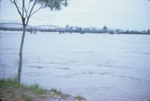
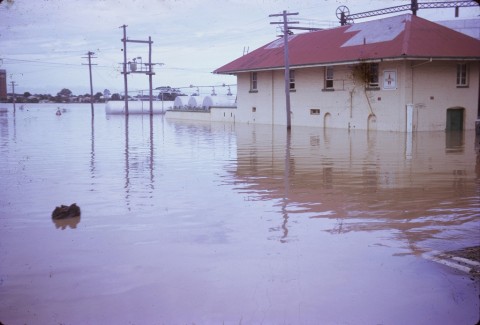
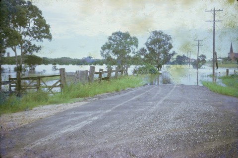
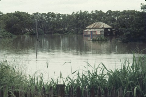
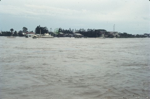
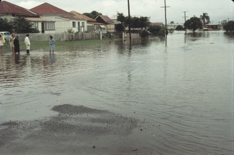
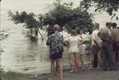
FLOODS 2011
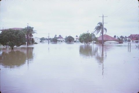
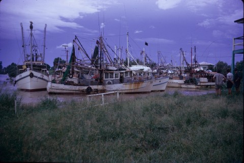
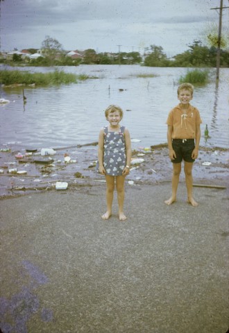
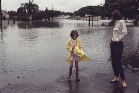
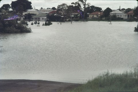
Flooding in Bundaberg began about 20 December 2010 and a Boxing Day deluge added to the difficulties. The Burnett River peaked at 7.92 metres on 29 December. (Previous peaks were 9.04 metres (1890), 8.91 metres (1893) and 8.48 metres (1942).) The Bundaberg and Saltwater Creeks, and their adjacent parklands flooded along with Quay Street East. The water overflowed from Saltwater Creek into Woongarra Street and Crofton Street among others. The port of Bundaberg was closed. Debris and silt were carried downstream by the Burnett River, and over twelve boats parted from their moorings. In all, about 300 houses were flooded to their floorboards, despite drainage and levee banks that had been improved in recent years.
Ex-Tropical Cyclone Oswald again damaged homes in January 2013. Parts of the Bundaberg marina businesses on the banks of the Burnett River collapsed in a sinkhole. The businesses were relocated and the area stabilised and turned into parkland.
Bundaberg's census populations have been:
| Census Date | Population |
|---|---|
| 1871 | 117 |
| 1881 | 1192 |
| 1911 | 5200 |
| 1933 | 11,466 |
| 1954 | 19,951 |
| 1976 | 31,189 |
| 1991 | 38,074 |
| 2001 | 44,556 |
| 2006 | 46,961 |
| 2011 | 49,750 |
Ben Anderson, The history of irrigation in the Bundaberg area, Brisbane, Strand Publications, 1978
John Kerr, Southern sugar saga, Bundaberg, Bundaberg Sugar Company, 1983
Janette Nolan, Bundaberg history and people, St Lucia, University of Queensland Press, 1978
Neville Rackermann, Bundaberg: from pioneers to prosperity, Bundaberg, Bundaberg City Council, 1992
Neville Rackermann, The growing harvest, Bundaberg, Bundaberg & District Fruit & Vegetable Growers' Association, 1987
J.Y. Walker, The history of Bundaberg (1890), facsimile 1977
Bundaberg suburbs entry