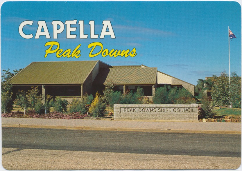
Peak Downs Shire Administration Offices, Capella

Genre:
Headwords:
Year Created:
Contributor:

Peak Downs Shire, an area of 8127 sq km, and generally 250 km west of Rockhampton, was amalgamated with three other shires in 2008 to form Central Highlands Regional Council. It extends almost to Clermont in the north and Emerald in the south, with most of the eastern half underlain by coal.
M.V. Purdie, ed, Capella: a brief history of the settlement of the Peak Downs, Capella, Book Committee, 1983
Isabel Hoch and Andy Plunkett, Tractors under the sky, Capella, Capella Pioneer Village Inc, 2000
W.J. McLaughlin et al, Peak Downs Shire handbook, Brisbane, Queensland Department of Primary Industries, 1979
Capella and Tieri entries
Copyright © Centre for the Government of Queensland, 2018. All rights reserved.
